Hello everybody!
These days, for weirdos like me, it’s really hard to figure out where to look as first. In Ukraine, the Russians have secured Sviatohirsk and are meanwhile infiltrating towards the last ‘big’ and ‘constructed’ Ukrainian defence line south of Zaporizhzhya (those who meanwhile understand how this war ‘works’, know of what ‘importance’ are such ‘field fortifications’).
In Iran… or around it: the king/majesty Dumpf of the USA seems to be setting up ‘help’ for protesters AFTER these have been massacred en masse by the IRGC-regime - to the degree where the protesting all but ceased - while at the same time ICE-ing protesters at home. And Israel is so horny to prompt him into an all-out attack on Iran - in order to distract from its continued genocide on Palestinians - that Netanyahu can’t care less if Dumpf is regularly dinning with Holocaust-deniers, and his aides are already openly considering a similar ‘turkey shot’ like when Israel has bombed all of Syria AFTER the fall of the Assadist regime.
If his majesty the king of the USA now has any kind of problem with this, then only because he can’t decide whether to launch an invasion of Iran or of Greenland… or monitor the developments in the Maduro process in New York. Obviously, anything’s better than the US public continuing to pay attention about how many dozens of children and infants have Dumpf & Co KG GesmbH AG raped with Epstein’s help over the years, or how much Israel continues genociding Palestinians, still with wholehearted support from the USA (and the EU/NATO).
In Syria, the government has kicked the terror organisation of Kurds from Turkey - the PKK, re-named the ‘Syrian Democratic Forces’ by the US CENTCOM (i.e. the Pentagon), so it can be supported by the USA and ‘the West’ - out of the Sheikh Maqsood District of Aleppo. Because the PKK/SDF-conglomerate had lots of fun sniping, mortaring, and UAV-ing civilians in neighbouring districts. And, because the PKK/SDF-conglomerate then ‘retaliated’ by deploying Iranian-made UAVs to target civilians in Aleppo, the Syrian Army has declared the area east of Aleppo and west of the Tigris River held by the PKK/SDF (see: Dayr Hafer area) an ‘exclusive military zone’, and requested all the civilians to evacuate. Guess, everybody can figure out what does this mean.
In Sudan, the UAE-Israel-Russia-instigated genocide run by the RSF continues - even more so because the allies of this lovely organisation continue supporting it with ever bigger shipments of arms. In turn, the junta in Khartoum is now trying to negotiate a new arms deal with Pakistan - where much of weaponry in question is going to be either of Chinese or Russian origin, or at least contain components from these two countries…
…and let me now not go on into the Rwandan invasion of the DR Congo, or the aftershocks of the recent war between Cambodia and Thailand…
One thing all these conflicts have in common is the use of StarLink satellite communication systems, GPS and ‘similar stuff’. The deployment of the same is nowadays of such importance that ‘even’ the Cyber Division of the IRGC in Iran has developed powerful jammers to disrupt their work. Between others, the last few days these have been deployed to disrupt Israel-supported attempts of the Iranian opposition to establish its own communication network in the country.
…and that in addition that, like in the case of Ukraine, the wannabe-Führer Musk is time and again threatening this or that party with ‘switching off’ StarLink services in selected areas.
As Benjamin is now going to explain: it’s not only about jamming, but Elon Musk can deny access, too. However, physics and mathematics don’t care about his personal preferenc… erm… ‘higher national interests of the USA’.
NOTE: This research is VERY long. Sorry. But there is a lot to cover. While finishing this research Iran has tried to cut off Starlink. They will fail. The army of transmitters required to deny Starlink to a country the size of Iran doesn’t exist. Nor is it likely Iran has the capability to “jam” the signals in all major cities. All any Iranian will need to do is visit his/her family in the village and the signal will be there.
Electronic Warfare is the ultimate cat and mouse game. It’s impossible to jam everything everywhere. And as you will see below, things you did not think were aids to navigation are in fact a bright shining lighthouse.
This research leans heavily on the work of Zaher M. Kassas, et al.
Persistent PDF Link: HERE
Precision navigation is a cornerstone of modern military operations. For decades, GPS (and other GNSS) have provided this capability – but these signals are vulnerable to jamming and spoofing in conflict zones[1]. This briefing explores a cutting-edge solution: using “signals of opportunity” from SpaceX’s Starlink satellite constellation as navigation beacons. Importantly, this method does not require connecting to the Starlink internet service or decrypting its communications. Instead, it exploits the mere presence of Starlink downlink signals – measuring their Doppler shifts and timing – to pinpoint a receiver’s position. Such techniques could enable Ukraine, Russia, China, or even non-state actors to navigate drones, missiles, or vehicles in heavily jammed or GPS-denied environments. The following sections provide:
● A plain-language explanation of Signal-of-Opportunity Navigation (SoOPNav) and how low-Earth orbit (LEO) satellites like Starlink can act as navigation aids without being decoded.
● A step-by-step walkthrough of how a drone or missile could use Starlink signals for guidance – including required equipment, signal processing, and achievable accuracy.
● Evidence that this method works, drawn from academic research (e.g. recent demonstrations by teams at Ohio State and UC Irvine) and industry.
● An assessment of the feasibility for various actors (state militaries and transnational criminal organizations) to adopt this method – with a visual example of a drone integrating Starlink hardware.
● A discussion of how Starlink-based navigation helps operations continue in jammed/GPS-denied areas – with references to Ukraine’s likely use in deep strikes, and broader implications for global conflicts.
(All information in this briefing is drawn from open sources, including academic papers and defense analyses, cited for reference.)
Signal-of-Opportunity Navigation (SoOPNav) is the practice of using ambient electromagnetic signals that were never intended for navigation, to determine one’s position. In essence, it turns any reliable signal source into a beacon. Instead of relying on dedicated navigation satellites, SoOPNav exploits everyday transmissions – from FM radio and TV broadcast towers to cell phone networks or satellite communications – as reference points[2]. By listening for these signals and analyzing characteristics like their timing, frequency, or signal strength, a receiver can calculate its own location without GPS. Notably, the receiver remains passive (it does not transmit anything), making the technique covert and resilient.
Readers searching for high-quality information - such as yourself - might prefer to support my work with a one time contribution vs a subscription. https://buymeacoffee.com/researchukraine
Your smartphone actually uses a form of SoOPNav when GPS is unavailable: it can estimate location by hearing nearby Wi-Fi signals, Bluetooth beacons, or cell towers, using databases of transmitter locations and signal strengths. Despite not using GPS, the phone’s location can be determined with startling accuracy[3]. This is a well-proven concept – far from a primitive backup, it is a complex and effective system in everyday use[4].
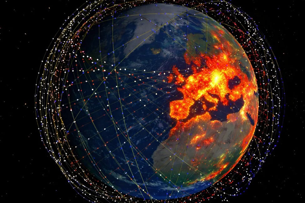
LEO Satellites as Navigation Aids: SoOPNav isn’t limited to terrestrial signals. The recent proliferation of LEO satellite constellations offers new “signals of opportunity” in the sky[5]. LEO communication satellites like SpaceX’s Starlink orbit much closer to Earth (~550 km altitude) than GPS satellites (~20,000 km). Because they are closer and often transmit at higher power, their signals arrive at receivers much stronger than GPS signals – on the order of 30 dB stronger (which is 1,000 times the power)[6]. Also, thousands of Starlink satellites are already in orbit, ensuring many signals are available at any given time over an area[7]. These attributes (strong signals and abundant satellites) make LEO constellations very attractive for navigation purposes[5].
Crucially, one can use LEO satellite signals without any cooperation from the satellite operator. In the case of Starlink, the satellites transmit continuous downlink communication signals to serve internet users. The signal structure is proprietary and encrypted for data, and Starlink does not broadcast a public navigation message (unlike GPS which broadcasts ephemerides and timing). Despite that, researchers have shown that with clever algorithms, one can treat Starlink’s downlink as a set of beacons and achieve nearly GPS-level positioning accuracy. This means extracting just a few key observables (like Doppler shift or signal arrival time) from the signals-of-opportunity, without decoding any internet data. In short, Starlink can be “misused” as a navigation constellation, even though it wasn’t designed as one. All that’s needed is a receiver that listens and a software-defined navigation solution – nothing transmitted, nothing hacked.
This approach falls under the fourth category of LEO-based PNT (Positioning, Navigation, and Timing) research: exploiting LEO signals opportunistically. It has gained significant attention as GPS jamming/spoofing has become “bread-and-butter” in modern electronic warfare[1]. Multiple research groups (and even SpaceX itself) are now treating Starlink as a potential navigation system. For example, SpaceX told the U.S. FCC in 2025 that Starlink user terminals already can achieve meter-level positioning accuracy by using time-of-arrival measurements from multiple satellites in the constellation[8]. In demonstrations, Starlink’s network has provided nanosecond-level timing and precise location for users even with GPS off[8][9]. This underscores that the concept is not theoretical – it’s being actively implemented as a resilient alternative or complement to GPS.
Emphasis (What SoOPNav with Starlink is not): It’s important to clarify that using Starlink signals for navigation is not the same as using Starlink’s internet service or breaking its encryption. A drone or missile doesn’t need to log into the Starlink network or transmit anything. It doesn’t gain internet access or decode the content of Starlink communications. Instead, the Starlink satellites are simply treated like “radio lighthouses in the sky.” The device listens to the downlink carrier signals and references their known properties (frequency, expected behavior) to deduce relative geometry. This passive approach means the satellite network is unaware of the navigation activity, and the user doesn’t depend on SpaceX or any provider – a critical point for military usage since it cannot be shut off by the provider.
In summary, SoOPNav turns the enemy’s or environment’s own emissions into a positioning system. Whether it’s a fixed TV tower that “never moves” or a swarm of Starlink satellites overhead, each signal source becomes a waypoint in an invisible radio map[10][11]. The next section explains how a vehicle can build such a map using Starlink.
Using Starlink signals for navigation involves a combination of specialized hardware and clever software, but the principle can be described step-by-step. Here’s how an unmanned aerial vehicle (UAV) or guided missile could navigate by exploiting Starlink’s downlink signals-of-opportunity:
Equipment – Receiver and Antenna: The vehicle is equipped with a radio receiver capable of tuning into Starlink’s downlink frequency band (Ku-band, around ~10–12 GHz). This is typically done with a software-defined radio (SDR) and a high-frequency antenna. The antenna doesn’t need to be as large as a Starlink dish used for internet; a modest directional or phased-array antenna can suffice to pick up signals from multiple satellites. An onboard processor (embedded computer) is also needed to run the signal processing and navigation algorithms in real-time.
Signal Detection: As the UAV/missile flies, the SDR continuously scans for Starlink transmission channels. At any time, dozens of Starlink satellites are above the horizon (often 100+ satellites in view worldwide given the size of the constellation)[7]. The receiver doesn’t know the data content, but it can detect the presence of a Starlink downlink signal because SpaceX’s signals have known formats – for example, certain synchronization sequences or pilot tones that the SDR can lock onto[12]. Researchers have developed techniques to identify Starlink signals out of the radio noise even without prior knowledge of the exact encoding – for instance, using a generalized likelihood ratio test to detect the satellite’s communication beacon, and algorithms to track the carrier frequency variation[12]. In practice, the receiver would detect multiple Starlink signals from different satellites in the sky.
Measuring Doppler Shift: Because Starlink satellites orbit Earth at high speed (approximately 7.5 km/s), their signals exhibit a noticeable Doppler shift when received. This means the apparent frequency of the signal is higher or lower than the nominal frequency, depending on the satellite’s relative motion toward or away from the receiver. The SDR will track the Doppler frequency curve for each satellite signal over time[13]. Essentially, as the satellite passes overhead, its signal frequency might drift by tens of kHz. The exact Doppler pattern is a function of the satellite’s orbit and the receiver’s own motion. By recording this Doppler vs. time (a distinct signature for each satellite), the system obtains a measurement related to the range rate (relative velocity) between the satellite and receiver. Each satellite’s Doppler measurement provides a constraint on the receiver’s position and velocity.
Measuring Signal Timing (Pseudorange): In addition to Doppler, the receiver can attempt to measure the time of arrival of the signals. If the receiver has a clock or can time-stamp when it receives a known reference point in the Starlink signal (for example, the start of a frame or a synchronization bit), it can get a pseudo-time-of-flight. With multiple satellites, differences in arrival time can yield pseudorange measurements (similar to how GPS works, though here Starlink doesn’t broadcast a navigation timestamp, so timing must be inferred or calibrated). Advanced methods use a reference station or prior knowledge to correct Starlink satellite timing errors and orbit errors. For instance, one approach is to have a distant “base” receiver that also listens to the satellites and periodically uplinks small correction parameters to the navigating vehicle to account for Starlink’s clock biases and imprecise orbital data. However, even without a reference station, a navigating receiver can use publicly available orbit estimates and still get useful accuracy, relying more on Doppler.
Calculating Position (Navigation Algorithm): Using the Doppler and/or timing observables from several satellites, the onboard processor now computes the vehicle’s position (and potentially velocity). This is done through a navigation algorithm – often an extended Kalman filter or least-squares solver – that iteratively adjusts the estimated latitude/longitude/altitude until the predicted Doppler/timing for the known satellite positions match the measured values. In simpler terms, the system knows (approximately) where the Starlink satellites are supposed to be (from orbit data) and it knows how fast frequencies are shifting; it then figures out the only receiver position that could produce those shifts. Each additional satellite signal adds another equation to refine the solution. With enough satellites (e.g. 4–6 good measurements), a precise 3D fix can be obtained. Early experiments demonstrated a horizontal positioning accuracy of ~10 meters by tracking the Doppler shifts from six Starlink satellites simultaneously[14]. More recent developments, using both Doppler and calibrated timing, have reached accuracies on the order of a few meters[15] – comparable to standard GPS accuracy.
Integration with Inertial Navigation: The vehicle’s onboard inertial navigation system (INS) – consisting of accelerometers and gyroscopes – plays a complementary role. In practice, Starlink signal navigation would be fused with inertial data to improve reliability. The INS can dead-reckon the vehicle’s movement for short periods during any brief outages or when fewer satellite signals are available. Meanwhile, the Starlink measurements provide periodic corrections to prevent the INS from drifting over time. This hybrid approach was demonstrated in a ground vehicle test: researchers navigated a car for nearly 3 km in a city using only Starlink Doppler fixes plus an onboard IMU, achieving meter-level accuracy[16]. The INS smoothed out motion, while Starlink signals kept the solution anchored to true position. In military drones or missiles, additional sensors (barometric altimeters, terrain-following radar, optical scene matching, etc.) can be layered in as well. Ukraine’s most capable drones likely use a layered suite of navigation systems – SoOPNav alongside GPS (if available), INS, terrain mapping, and visual recognition – so that no single point of failure exists[17].
Guidance and Control: Once the navigation system computes the vehicle’s position and velocity, this information feeds into its guidance system just like a GPS solution would. The drone or missile can then stay on its programmed course or seek targets coordinates. The key difference is that now it can do so even if GPS signals are blocked or spoofed. The Starlink signals effectively replace or augment GPS, telling the autopilot where the device is in real time. The accuracy achieved (ranging from a few meters to perhaps tens of meters, depending on setup) is sufficient for many targeting purposes – certainly enough to navigate into the general vicinity of a target or keep a drone on course for long range, especially when combined with a final optical or terminal guidance for precision.
It bears emphasizing how quiet and resilient this method is. The vehicle is a passive listener; unlike active radar navigation or radio-altimeters, it emits no signal for the enemy to detect. To the adversary, the drone is dark – it’s not broadcasting any tell-tale RF energy while it finds its way. Meanwhile, the enemy’s own environment is filled with these “signals of opportunity” that the drone can use. Even the Starlink satellites belong to a civilian company and blanket the combat zone with communications signals that a military can leverage. So, in a sense, a combatant can piggyback on infrastructure that is already in place and not easily removed. This leads to the next points: the real-world evidence that this works, and the feasibility of different actors adopting it.
Readers searching for high-quality information - such as yourself - might prefer to support my work with a one time contribution vs a subscription. https://buymeacoffee.com/researchukraine
Academic and industry research over the past few years has convincingly demonstrated that Starlink-based navigation is more than theory. Below is a summary of key results and evidence:
● Initial Proof-of-Concept (2021 – UC Irvine): A research team at the University of California, Irvine (led by Prof. Zaher (Zak) Kassas) published the first public demonstration of positioning using Starlink signals in 2021. In their experiment, they did not have access to any Starlink insider information – they simply observed the downlink signals. By tracking the Doppler shifts from only six Starlink satellites, they were able to compute a horizontal position of a ground receiver with about 10 meter error[13]. This was achieved using a custom software-defined receiver that detected the satellites’ unknown signals and a positioning algorithm based on Doppler observables. The result was significant: 10 m accuracy from opportunistic signals was far better than random guessing and showed the method’s promise.
● Advancing to Meter-Level Accuracy (2023–2025 – Ohio State/OSU & UCI): Follow-on research, notably by a team involving The Ohio State University (where Prof. Kassas later continued work) and UCI, has greatly improved the accuracy. In 2023-2024, the researchers added techniques to derive pseudorange (distance) measurements from Starlink signals and to correct for uncertainties in the satellites’ orbits and clock timing. One article in Inside GNSS reports the most accurate Starlink PNT results to date: a stationary receiver could localize itself to within 2 meters in under 20 seconds, and a moving ground vehicle was navigated for 3 km with meter-level accuracy using only Starlink Doppler readings plus an IMU[15]. Impressively, that moving test had no GPS at all – it was “exclusively” Starlink-based navigation, with the help of a reference station broadcasting small corrections[16]. This shows that Starlink can essentially perform as an alternative navigation system approaching the precision of standard GPS (which for civilians is on the order of 3-5 m accuracy). The phrase “nearly GPS-like PNT performance” is used by the researchers. In other words, exploiting Starlink’s communication signals can almost substitute for GPS, a remarkable achievement given Starlink was not designed for this.
● Multiple Independent Tests: The research results have been replicated and extended by multiple groups. The U.S. Department of Transportation has funded investigations (e.g., via the CARMEN program) into leveraging LEO constellations for navigation resiliency[18][19]. The U.S. Army and Air Force have also shown keen interest. In fact, SpaceX itself has acknowledged and embraced these capabilities. In May 2025, SpaceX responded to an FCC inquiry on PNT resilience by highlighting that Starlink satellites could provide robust positioning and timing services. They noted Starlink has been tested by U.S. military and civilian users in degraded GNSS environments, proving its utility in real-world conditions[9]. SpaceX claims its user terminals can already achieve nanosecond-level timing and meter-level positioning accuracy autonomously[8]. SpaceX’s CEO Elon Musk even remarked that Starlink could offer far more robust positioning than GPS long-term (given thousands of satellites, stronger signals, etc.)[20].
● Signals of Opportunity Beyond Starlink: Although Starlink is the largest LEO constellation, it’s worth noting that the general concept has worked with other satellite systems too. Researchers have also tried OneWeb LEO satellites and even older Iridium satellites as navigation beacons, with positive results[21]. This underscores that the approach is not unique to Starlink – any stable transmitters can be leveraged. However, Starlink’s sheer scale (over 7,000 satellites in orbit by mid-2025[7]) and signal power make it the prime candidate for military-grade SoOP navigation at the moment.
● Wartime Use and Reports: While much of the concrete evidence comes from controlled experiments, there are growing indications that these techniques are making their way into active conflict zones. In the Russia-Ukraine war, Ukraine has faced intense GPS jamming by Russian electronic warfare units[22]. Yet Ukraine has conducted successful long-range drone strikes and guided munitions deep into Russian territory – feats that, as analysts have pointed out, likely required alternative navigation methods[23]. A detailed commentary in March 2023 predicted that “Ukraine is already using – or will soon use – SoOPNav to guide drones and long-range munitions” even in the most hostile EW environments[24]. The same source later noted evidence that Moscow began turning off or limiting civilian broadcasts and communications to try to thwart Ukrainian SoOPNav[25]. In other words, Russia implicitly acknowledged the threat by making parts of its electromagnetic terrain go dark (an extraordinary measure to deny the Ukrainian weapons any signal to latch onto). Furthermore, the Resilient Navigation & Timing Foundation reported that “Starlink was used to overcome Russian jamming in the early phases of the war in Ukraine and can be used for PNT when GNSS is not available.”[26] This aligns with reports that Starlink’s service provided a lifeline not just for communications but also potentially for navigation when Russia tried to cripple Ukraine’s GPS.
Taken together, these points build a strong case that Starlink-based navigation is feasible and effective. It has moved from academic labs to being tacitly employed in conflict, and even the company operating Starlink sees it as a viable PNT solution. The next question is: how accessible or practical is this method for various actors – from nation-states with advanced militaries to non-state groups?
(…to be concluded in the Part 2…)