Built for the geospatial power user
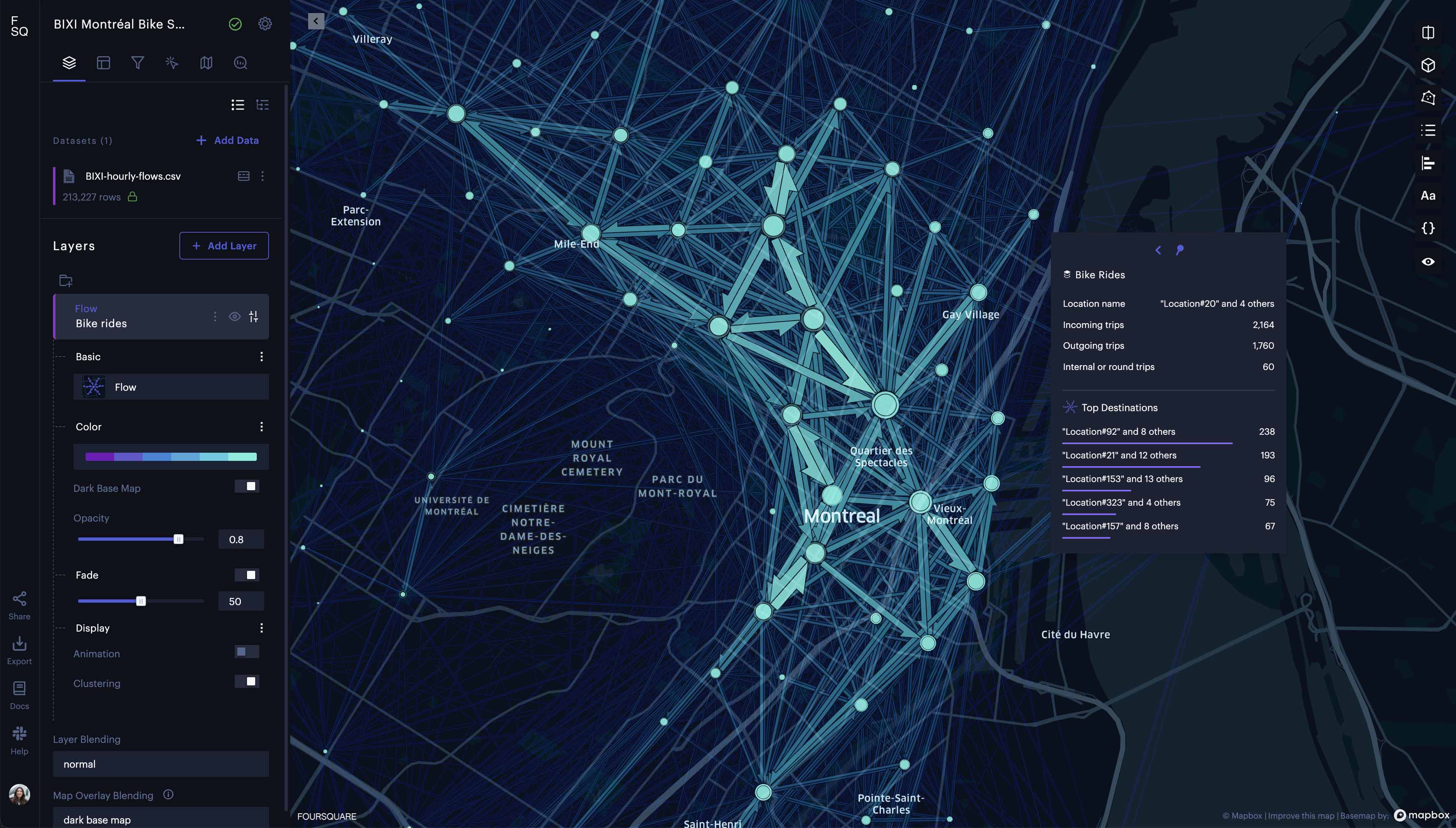
Layers
Access a growing set of layer types including Flow, 3D, Vector, Raster Tile, and more. Layer Glossary
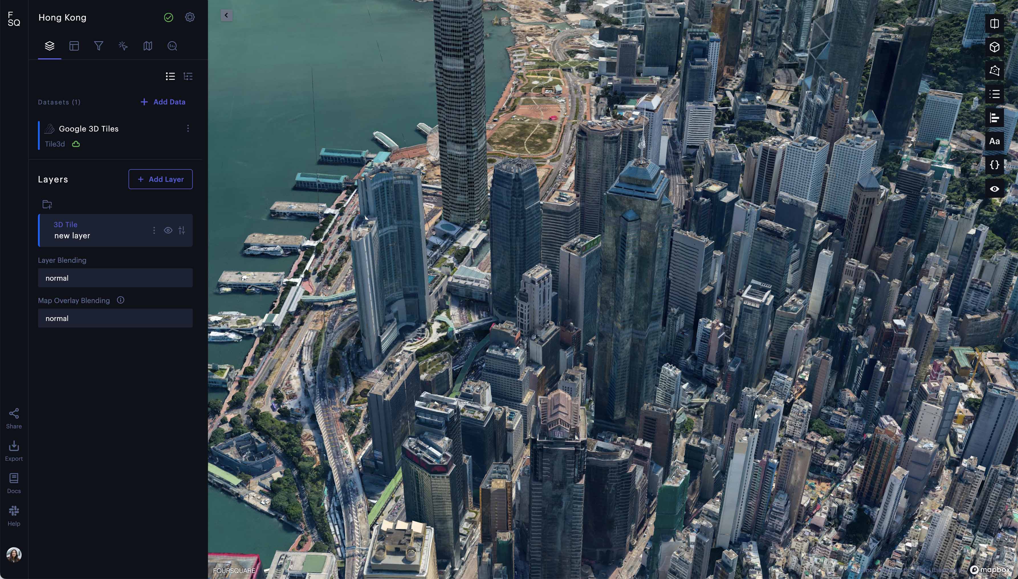
3D visualization
Stream and render massive 3D geospatial datasets with 3D view, including a Globe Mode.
Spatial analysis
Extract insights in minutes with analysis modules including cluster-outlier and suitability analysis.
Charts
Add various statistics and charts to maps including bar, line, heatmap, and tooltip charts.
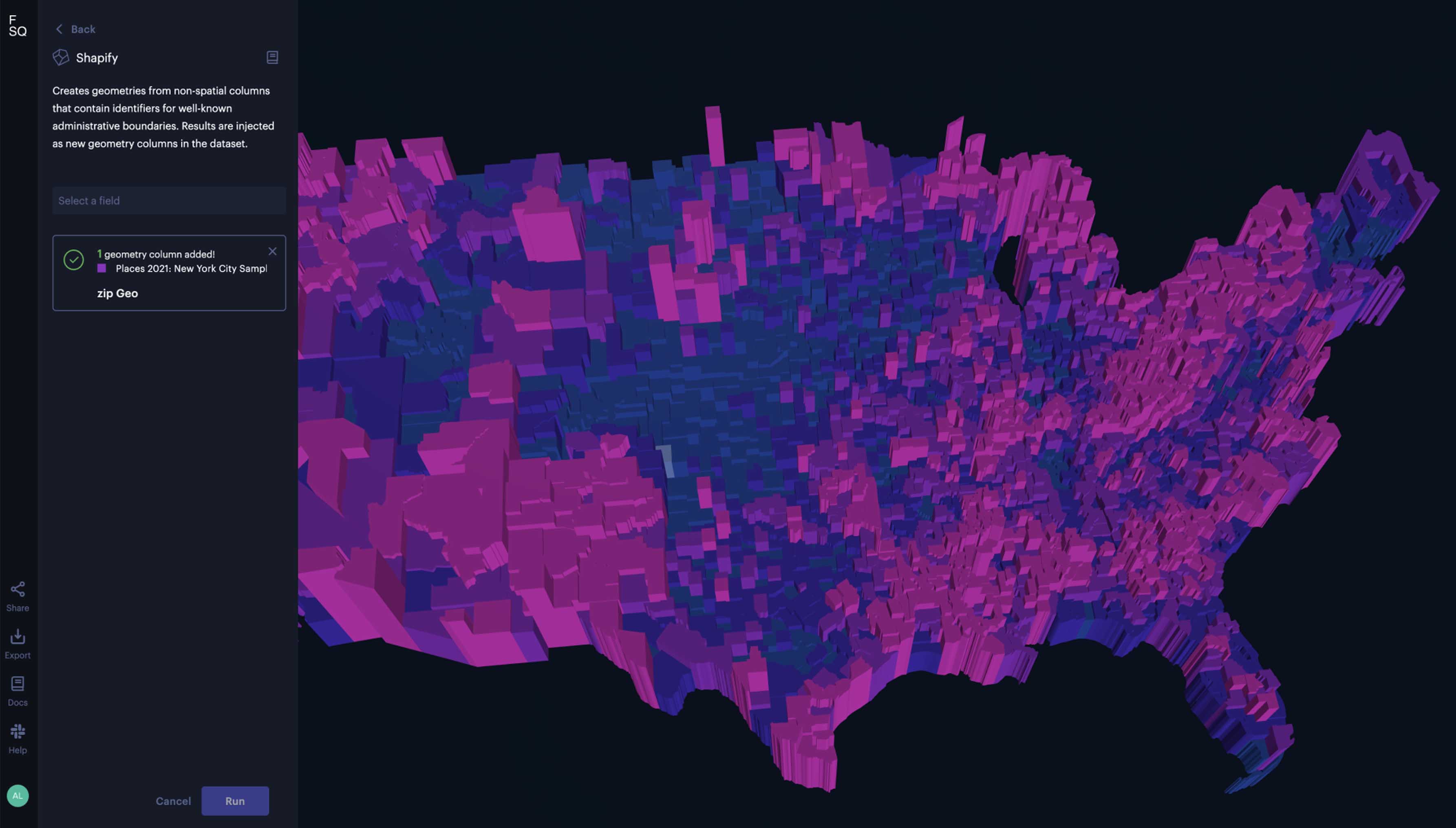
Administrative boundaries
Auto generate boundaries from dataset columns containing well-known administrative identifiers (e.g. county, state, zip code) with Shapify.
Publish and share maps
Share access with various export options where users can update and republish to the same URL, control visibility settings, password-protect maps, and more.
Data import
Import/export a wide range of data formats, including: CSV, GeoJSON, Shapefiles, and Vector Tiles among others.
Data operations
Apply expression, extract, group-by, spatial join and union operations.
Animation
Export videos at a resolution of 1440p, and animate across datasets with custom models, configurable trails and more.
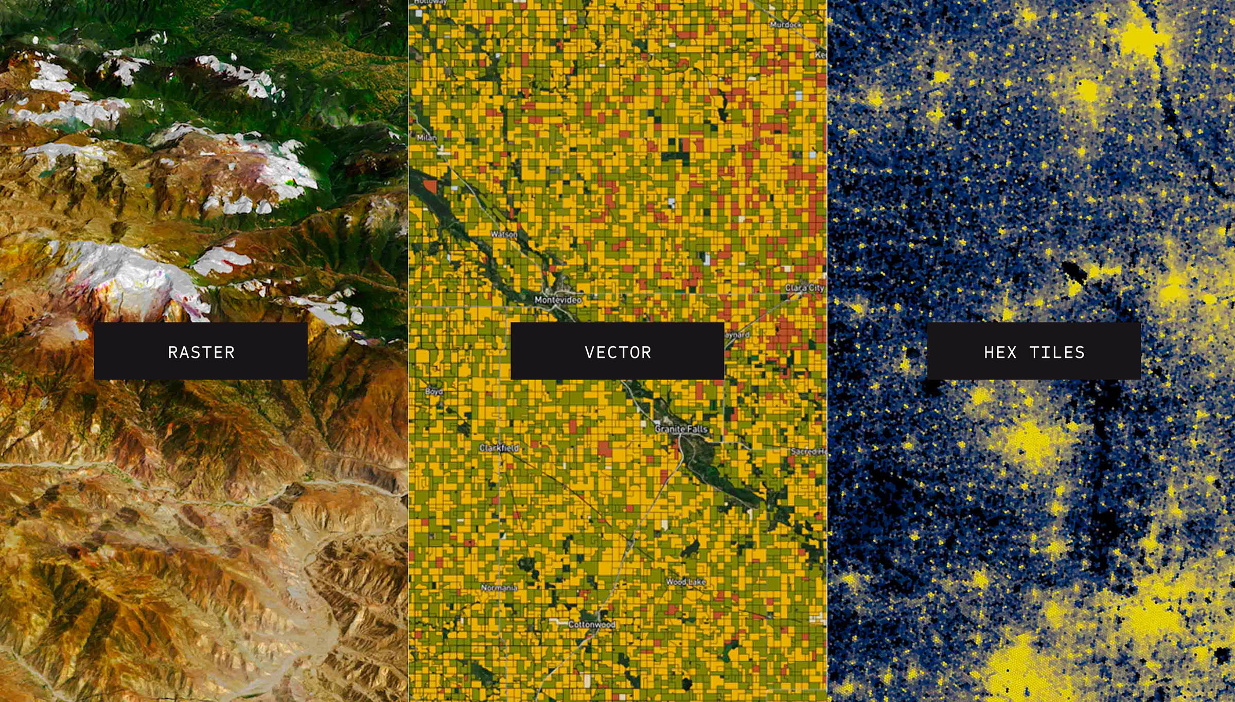
Hex Tiles
Utilizing H3, Hex Tiles unify diverse spatial datasets with ease, explore big data at interactive speeds, and work with data in tabular view–all while maintaining full data integrity at all resolutions.
Data catalog
Our growing library of curated spatial datasets includes demographics, infrastructure, elevation, weather, remote sensing, and more.
Layers
Layers3D visualizationSpatial analysisChartsAdministrative boundariesPublish and share mapsData importData operationsAnimationHex TilesData catalog
Access a growing set of layer types including Flow, 3D, Vector, Raster Tile, and more. Layer Glossary
Stream and render massive 3D geospatial datasets with 3D view, including a Globe Mode.

Extract insights in minutes with analysis modules including cluster-outlier and suitability analysis.
Auto generate boundaries from dataset columns containing well-known administrative identifiers (e.g. county, state, zip code) with Shapify.
Share access with various export options where users can update and republish to the same URL, control visibility settings, password-protect maps, and more.
Import/export a wide range of data formats, including: CSV, GeoJSON, Shapefiles, and Vector Tiles among others.
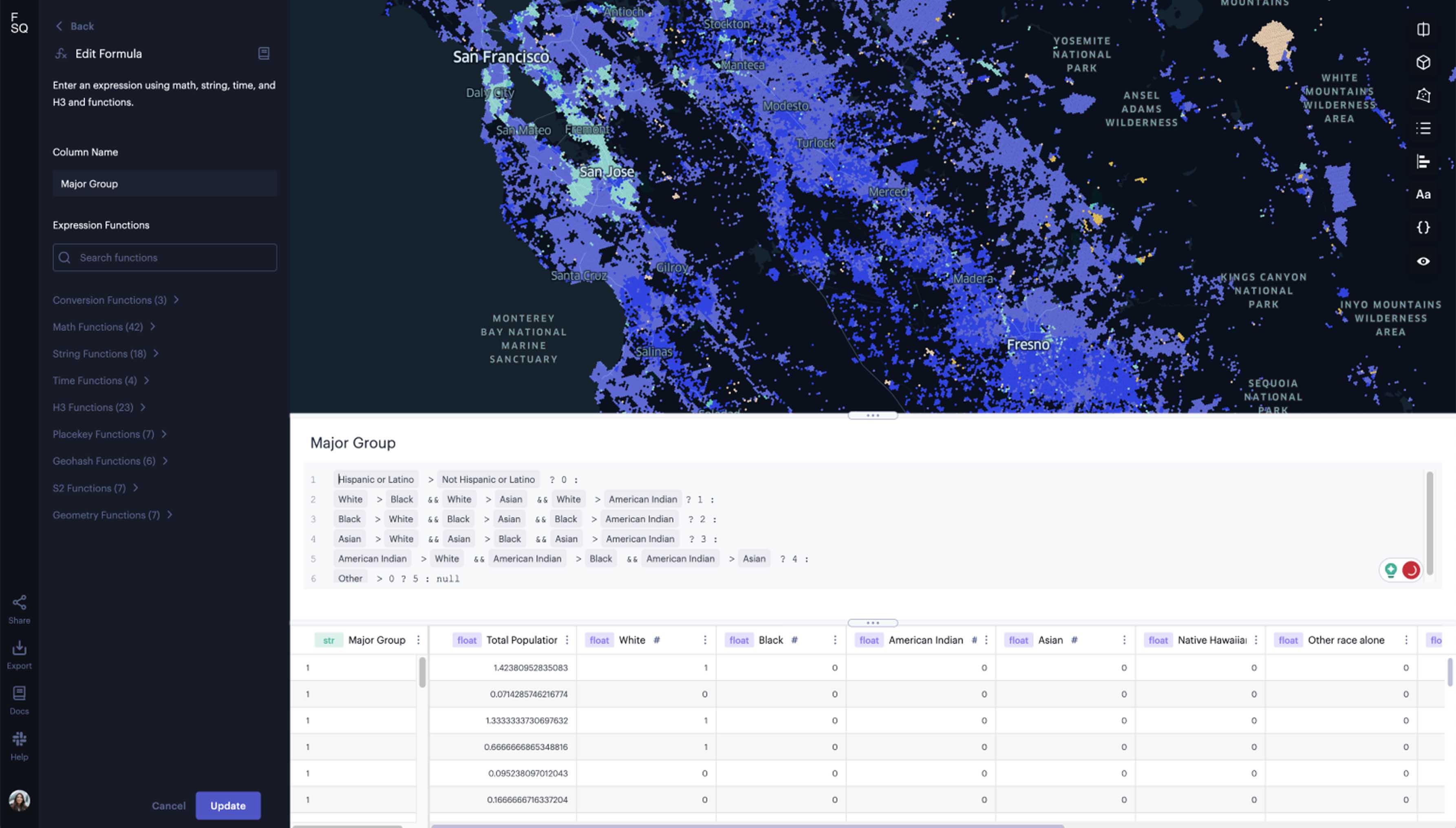
Apply expression, extract, group-by, spatial join and union operations.
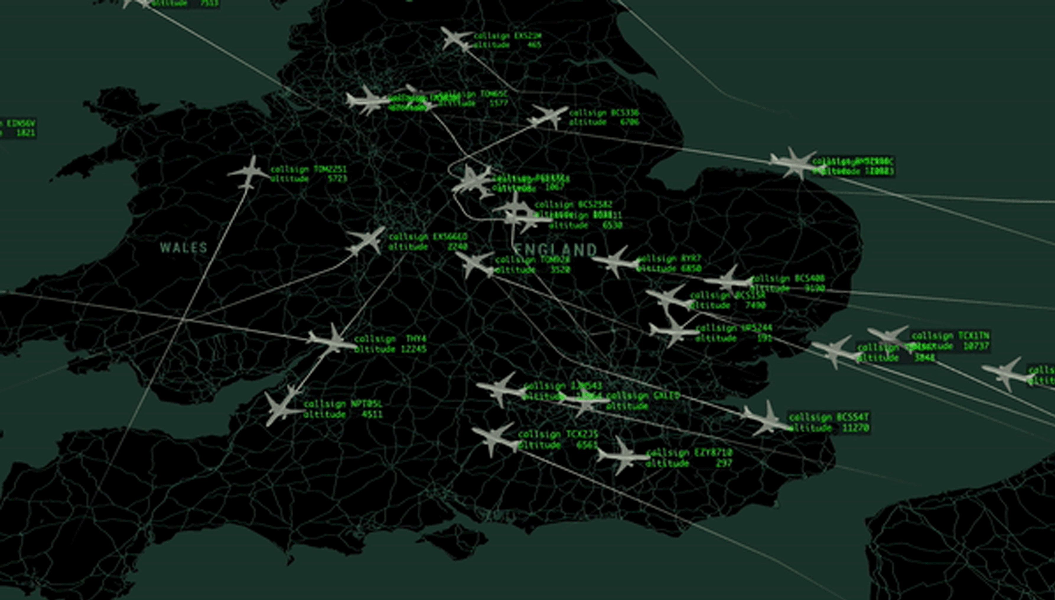
Export videos at a resolution of 1440p, and animate across datasets with custom models, configurable trails and more.
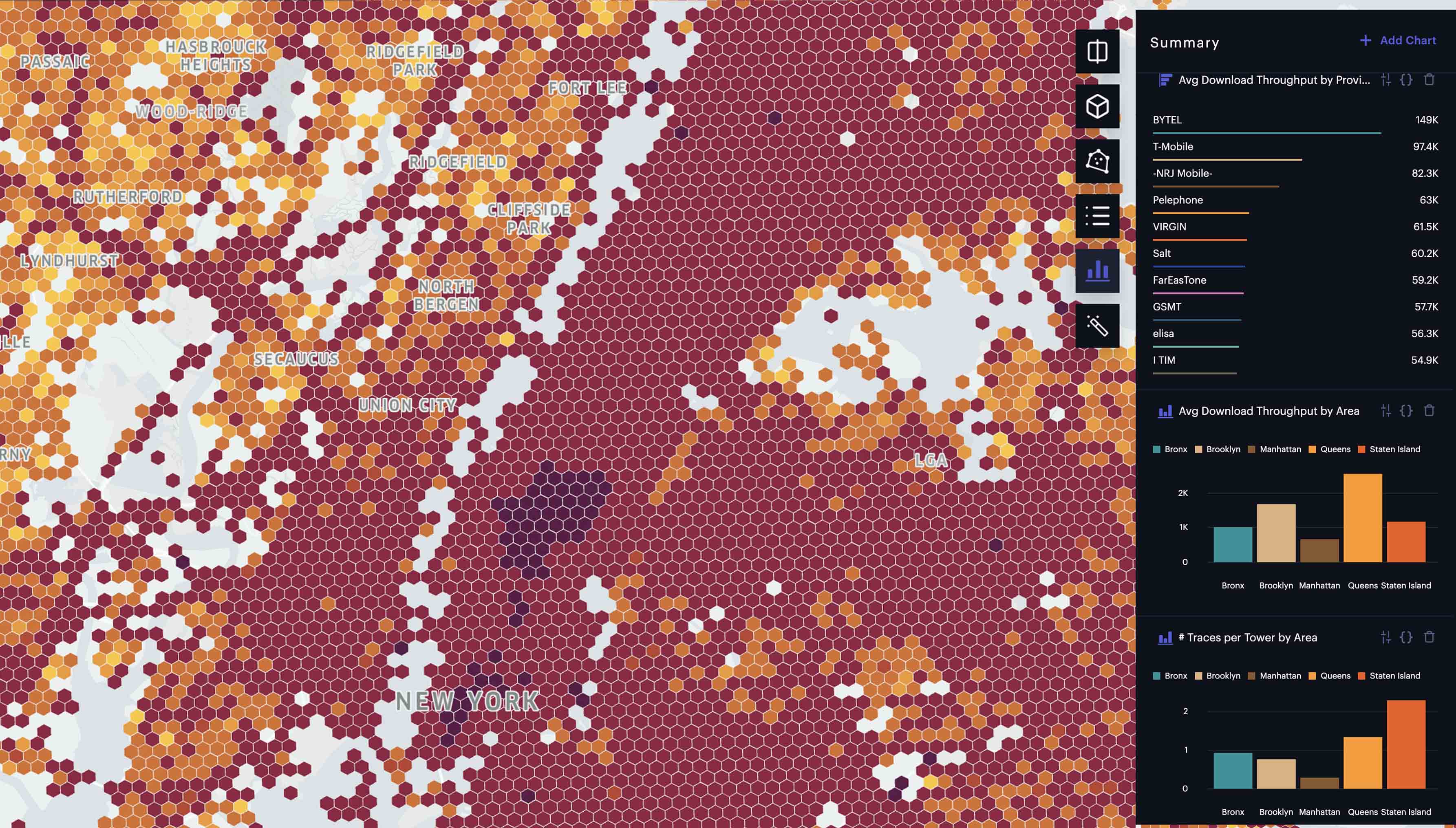
Utilizing H3, Hex Tiles unify diverse spatial datasets with ease, explore big data at interactive speeds, and work with data in tabular view–all while maintaining full data integrity at all resolutions.
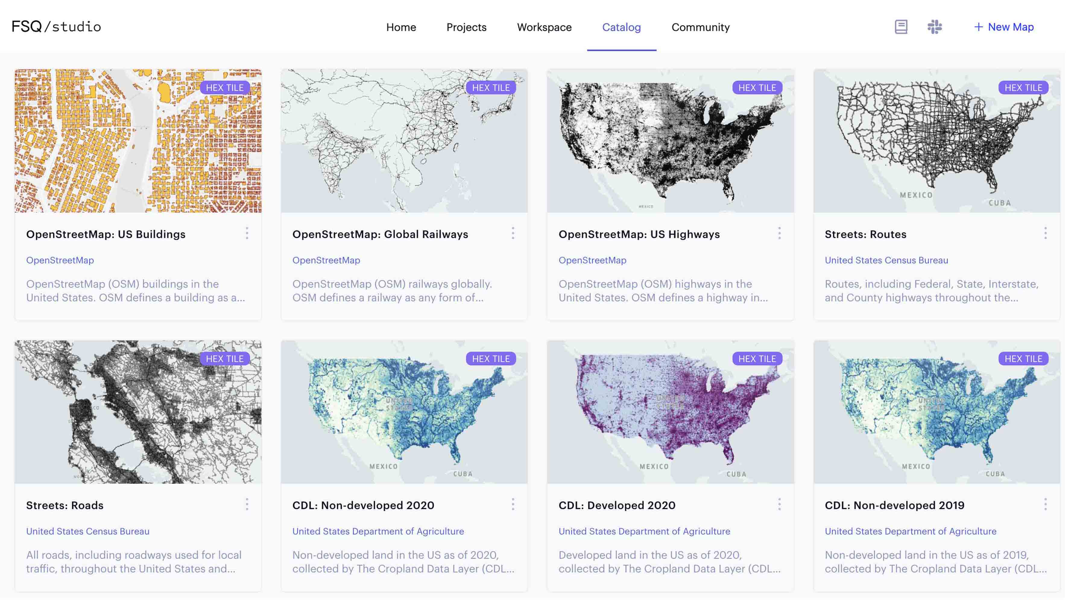
Our growing library of curated spatial datasets includes demographics, infrastructure, elevation, weather, remote sensing, and more.
Solve real-world problems
| FSQ Spatial Studio | FSQ Spatial Desktop | FSQ Spatial Workbench | |
|---|---|---|---|
| Pricing | Free | $25 per month | $250 per month + compute usage |
| Cloud Storage | 1GB | 3GB | 5GB |
| SQL Workbooks | No | No | Yes |
| Dashboards | No | No | Yes |
| Kepler.gl Foundation | FSQ Kepler | OSS Kepler | FSQ Kepler |
| Bring Your Own DB | No | No | Coming soon |
| Flow Map Layer | No | Coming soon | Yes |
| Cloud Native Geospatial Format Support | Limited | Yes | Yes |
Developer tools that build and integrate directly into your stack
Get started with Foursquare Studio
Use your geospatial data to tap into powerful insights