
The Accessible Flight Simulator
Free - Web Based - Multiplayer - Global Satellite Images

GeoFS is a flight simulator with a global environment generated from satellite images and digital geographic data.
You can run it for free in your web browser without anything to install, subscribe to worldwide HD aerial images (suitable for VFR flight) or install the available mobile Apps.
Dedicated plans for schools or businesses are available with GeoFS PRO
- Free 1 meter/pixel, AI enhanced, global satellite images Aerial HD imagery on subscription.
- Massively multiplayer
- Navigation charts with 40,000 referenced runways
- cell_tower Radio Navigation (GPS, ADF, VOR, NDB, DME)
- ADS-B (real-life) commercial traffic in real-time
- Runs on Windows, Mac, Linux, Mobile (iOS, Android)
- Joystick support
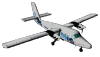
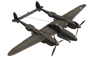
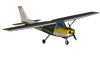
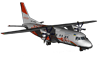
- 30 available aircraft (+ community contributed)
- Configurable or real-time weather (METAR) wind, turbulences, thermals, ridge lift, clouds, precipitations, fog





























- GeoFS is using Cesium, a virtual globe framework (just like Google Earth) that provides worldwide photo-realistic landscape.
- GeoFS is available for free with global standard resolution (10 meters per pixel) satellite images.
- Or it can be enhanced with a HD subscription to fly over high resolution, photo-realistic landscape. (Microsoft Bing Maps aerial images).
- GeoFS HD is particularly suitable for VFR practice as it makes easy to spot landmarks, roads and other small details used for navigation.
- Take a look at the screenshot gallery for more examples.
- Learn more about GeoFS HD here. You can try GeoFS HD for free, for one day.
Global satellite images
- Day/Nights cycles can be set manually or naturally based on location
- PAPI and Runway lights are available on major runways to help with approach.
- The location presets offers to fly directly to places of interest,
- or you can just search for any location and be instantly placed at the right spot.
- The map also provides everything required for navigation with air space, traffic, navaids and about 40,000 runways for take-off/approach.
- You can fly absolutely anywhere in the world.
Accessible and realistic
- GeoFS is a real flight simulator and provides a realistic physics engine.
- Flight dynamics is based on the laws of physics and simulate lift, drag and stall on all aircraft surfaces as you fly. Controls and instruments are simplified to make everything easier, even without any experience.
- Aircraft have been tweaked to match real-life performance.
- Instruments, are accurate and functional and all the newest GeoFS aircraft are equipped with a virtual cockpit.
- Weather data is retrieved from openweathermap.org, and processed to generate real-life atmospheric conditions at your current location
- Ridge lift is modeled so it is possible to practice soaring with the available gliders.
- Some aircraft are fitted with an autopilot.
Massively multiplayer
- Fly together with other pilots and join one of the many GeoFS related Discord servers listed on Disboard.org for voice communication and community events
- Get surounded with real-life commercial traffic with live and global ADS-B transponder data.