
Try out our new AI Search Assist!
While browsing the collection in LUNA, click the blue chat icon in the bottom right to ask the new AI Search Assist questions. Read more about what you can do on the AI Search Assist page
Some example searches:
- Show maps of Ancient Rome
- Translate title to English
- Find maps with compass roses
- Show maps that feature propaganda
- Find maps that show details of rivers

NEW: Search byText-on-Maps! To learn more, see the About Text on Maps Help Guide
Here are some of our favorites:
Now showing!

A Stranger Quest
Documentary - Art Film
For David Rumsey, maps constitute the fabric of memory. They carry images of boundless worlds and the people who live there — past, present, and even the future. In the film A Stranger Quest by Andrea Gatopoulos, David takes us on a journey through time and space as he recalls why he started collecting. Over decades the collection grew into the intricate, innovative, and intimate story of his life and all the lives that have touched him.
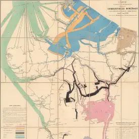
, 1886-;1935;14533.024") Pilsētu iedzīvotāju nacionālais sastāvs tautas skaitīšanu gados. = Effectif national de la population des villes dans les années de recensement ...;Skujenieks, M. (Marg̓ers), 1886-;1935;14533.024
Pilsētu iedzīvotāju nacionālais sastāvs tautas skaitīšanu gados. = Effectif national de la population des villes dans les années de recensement ...;Skujenieks, M. (Marg̓ers), 1886-;1935;14533.024
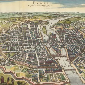
 Composite: Feuilles No. 1-24 Carte Générale des Royaumes de Naples, Sicile & Sardaigne;Bacler d'Albe, Louis-Albert-Ghislain, 1761-1824;1802;15716.034
 Sbornaia karta;Leningrad, Gosudarstvennoy Kartografii;1925;13455.012
 Composite: Sheets 1 - 20, Karte der Schweiz;Woerl, Joseph Edmund ; Herder, Bartholomew;1835;6824.023
 Physical Map of Scotland.;Sonnenschein, W. Swan; Allen; Bevan, G.P.;1880;2490.022
Welcome to the David Rumsey Map Collection. Here you can explore maps through a variety of viewers. Read the Blog to learn more about collection highlights, such as Urbano Monte's manuscript world map from 1587. Visit the physical collection at the David Rumsey Map Center at the Stanford University Library. Or take a virtual tour of the Map Center, which hosts events such as the recent Barry Lawrence Ruderman Conference on Cartography : Indigenous mapping.
The historical map collection has over 143,000 maps and related images online. The collection includes rare 16th through 21st century maps of North America, South America, Europe, Asia, Africa, Australia, Antarctica, the Pacific, the Arctic, and the World. The online map collection is a searchable database that allows you to make your own journeys into spatial representations of the past. Here you can see the history of cartography through primary sources from 1500 into the 21st century.
NEW: Random Browse the collection (desktop and tablet only). 250 images at a time. Refresh the link to see 250 more. We invite you to get pleasurably lost.
Advanced search allows refined inquiries for precise results, while browsing encourages serendipitous exploration, honoring the legacy of library shelves. Popular collection categories include data visualization, celestial maps, atlases, globes, school geography, maritime charts, city atlases, pocket maps, children's maps, and manuscript maps. Subject and place examples: Pictorial, Geology, California, New York City, U.S. Civil War, Afghanistan, Moon, Mountains and Rivers, Migration, Languages, Religions, Railroads, Climate, Agriculture, Economics, and Zoological. Browse search facets: What, Where, Who, When. The collection supports the study of topics such as history, ethnography, technology, environmental science, genealogy, and art. Learn more
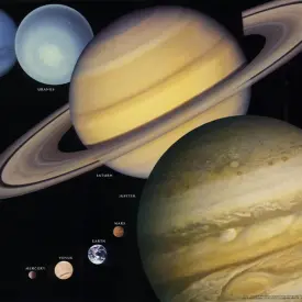
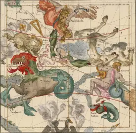
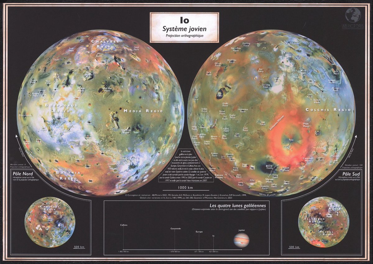
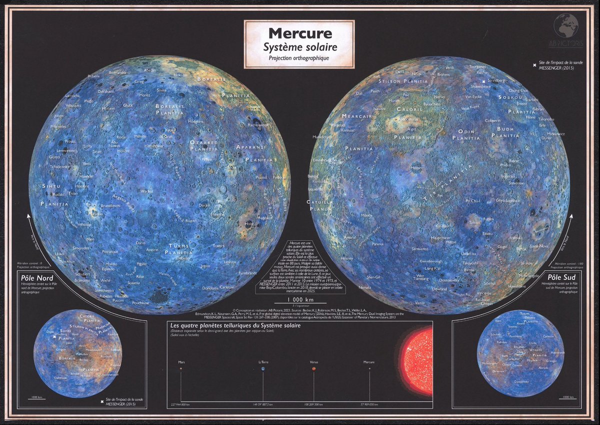
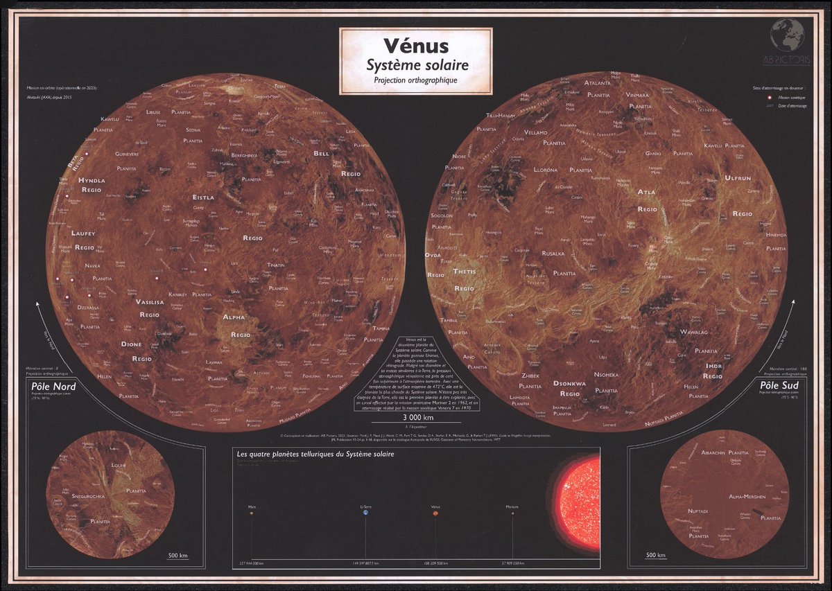
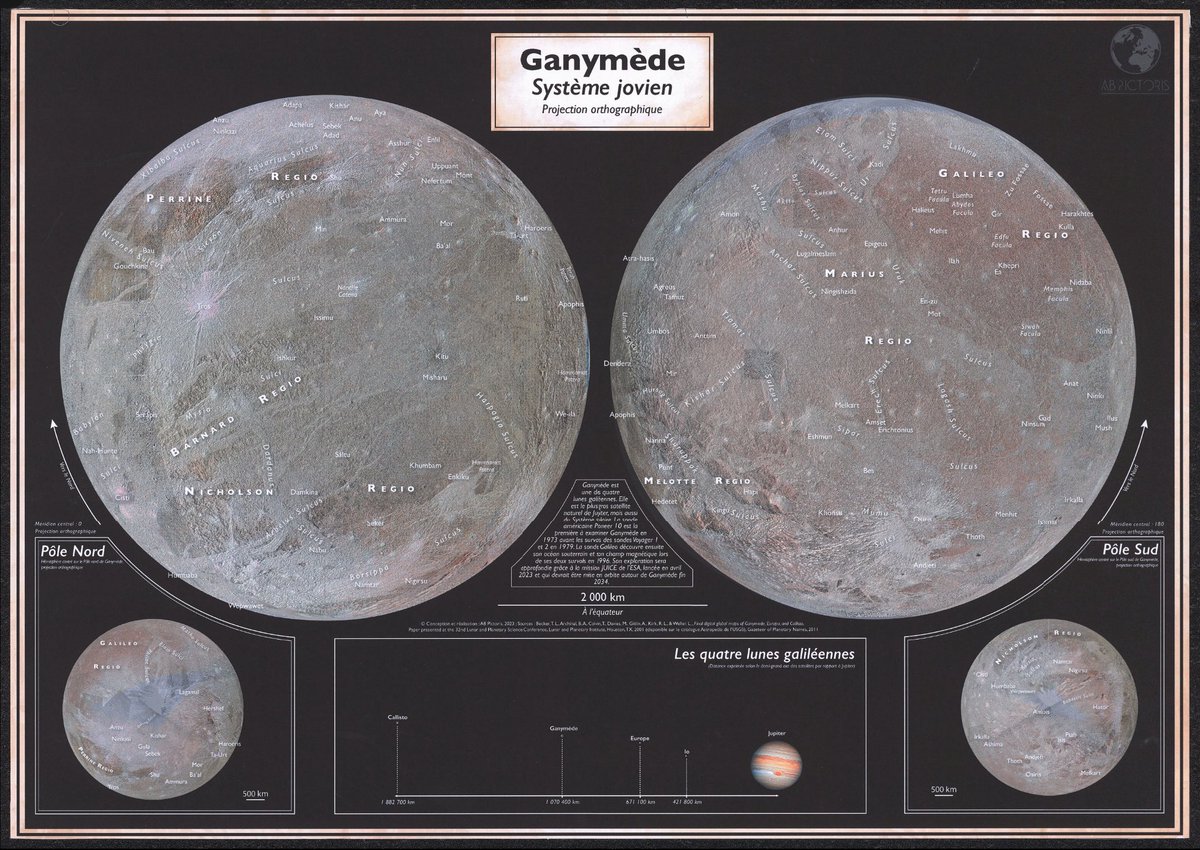
9 beautiful Planets and Celestial Maps by Blanche Lambert - @blambertcarto / @AbPictoris See all 9 here https://t.co/786bHaWYDe https://t.co/W92gHTr96F
“Pacific Watershed: Land of Contrasts” (Richard Edes Harrison, 1945) — A dramatic bird’s-eye map of the American West showing the vast Pacific drainage system from the Columbia River to the Colorado and Great Basin. Highlights the region’s extreme contrasts—glaciers, deserts, https://t.co/UNTCsgNoeL


Simms Campbell’s 1933 “A Night-Club Map of Harlem” - a witty, vibrant portrait of the 1930s Harlem Renaissance. Created by the first nationally prominent Black cartoonist, it spotlighted clubs like the Cotton Club & Savoy Ballroom. Now exceedingly rare. https://t.co/KJZhAMyMpB https://t.co/wSOl5HDPy2


New acquisition for the Rumsey Map Collection: Huge Dioramamap San Francisco 2016 by Sohei Nishino. 170cm x 256cm https://t.co/RML60jOLJm https://t.co/suQi9YpoD3


MacKinnons Brook, Cape Breton Island, Nova Scotia - Drone footage, Oct 21, 2025. Left house restored by David Rumsey in 1988; right built by Rumsey in 1964. Both now part of an 8,000-acre conservation area of Nova Scotia Nature Trust. 5 km of roadless coastline. 25 km of trails. https://t.co/fahwbsJhir
Explore the oil geopolitics of the 1960s with Brian Orchard Lisle’s detailed 1965 “Map of the Near and Middle East Oil.” A striking artifact of petroleum history, it charts fields, pipelines & power. https://t.co/qzQqOVqmQu 7th edition of the Map of Near and Middle East Oil. https://t.co/vHh2cMz5ll

The Computer Tree II (1979, Management Information Corp.). A data visualization chart of computer evolution from Babbage & ENIAC through IBM, DEC, Fujitsu—branches of tech growth that might one day be called AGI’s roots. https://t.co/lWJlOr6j18 https://t.co/VoQfRM7DQj

This 1984 pictorial map by William Burks III depicts Crazy Horse’s territory (1841–1877), blending Lakota iconography and a chronological border of key events, highlighting Native American history and culture. https://t.co/YNkP4eaW9f https://t.co/CIMnao88eY

A vivid 1948 pictorial map by G. Runge for Northwest Orient Airlines, highlighting postwar optimism & new transpacific routes. Bold colors & dynamic lines reflect the era’s drive for global connectivity. https://t.co/Fo97EjAJIh https://t.co/vGwbrPqfbi

1967 Red Guard map, “China as the Center of World Revolution,” shows Mao’s China as the epicenter of global revolution, spreading communist ideology worldwide during the Cultural Revolution. https://t.co/rPDAkn82Ks https://t.co/00lxJbDGg8


Striking 1943 WWII anti-malaria map by Dr. Seuss (Theodor Geisel), and the U.S. Army. Designed to warn soldiers about malaria, it uses bold colors and cartoonish humor to highlight global malaria risk zones. https://t.co/NBnrk3o8kV https://t.co/LgOjQG5q55

1958 Interplanetary Space Guide https://t.co/sM2WjNIpqk https://t.co/umR0aZbUVd
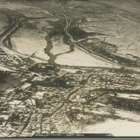
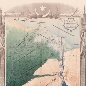
Scene of the Landing operations at the Dardanelles. https://t.co/u55xepV4SG https://t.co/IF4mO5fqDV

Try our new AI Search Assist. Find historical information on maps. Translate language from maps or map descriptions. Ask with whole sentences - makes search a conversation. Examples: find maps with compass roses or show maps that use propaganda. More at https://t.co/VpA72pAN53 https://t.co/zojJXIgDn5


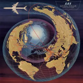
1,249 likes, 46 comments - jamenpercy.burn on August 7, 2025: "‘The Speed of the Earth’ by Kevin Kelly @kevin2kelly and David Rumsey was a fascinating artwork and bit of tech. What looks like just a flashing set of lights nearly a mile long, was far more than that. The lights are programmed precisely at the speed of the Earths rotation, each Independently lighting up with a pulse of light using GPS. This gave the viewer a visible representation of how fast we are spinning through space on this crazy round rock. The sheer sense of scale is mind blowing and an excellent piece viewed from above! #thankslarry #burningman #burningman2024 #blackrockcity @industwetrust @burningman #curiousandcurious #burningmanart #brc #brc2024 #10principles @burningmanphotos @burningman_photos #blackrockcity #mavic3 #drone #aerial #fromwhereidrone".
TeleGeography, Inc. has been mapping global telecommunications since 1996. Their maps illustrate the remarkable growth of the Earth’s communication exoskeleton, formed by undersea cables and satellites. Explore 37 of their maps at: https://t.co/dQhm2gt4mS https://t.co/hqeZ87Abxn


1877 Eadweard Muybridge Panorama of San Francisco in 11 sheets. One of the landmarks of 19th-century American photography, and an iconic panoramic image of San Francisco, accompanied by the rare Key to Muybridge's work. High resolution image https://t.co/FwYuIua98P https://t.co/VoGr3Igb1L


A Stranger Quest, a documentary and art film combined by Andrea Gatopoulos, surveys the life of David Rumsey and his passion for maps. The film was released to the public in December 2024. Watch it in its entirety at https://t.co/YSgPR6rkpD https://t.co/oYRQ73UU5Z


60,000 new maps, views, texts, titles, diagrams, globes, timelines and more have been added to search for Text on Maps - doubling to 120,000 items from the original 60,000 we started with a year ago. Over 175 million words indexed! Try searching for Cairo https://t.co/481hMN9ahN https://t.co/jfG40qk2OQ


The Speed of the Earth, lights move at rotational speed of earth on axis, 1156ft/sec at lat 40.79571, lon -119.18323. Using GPS to time the flashes. A moving map. https://t.co/QZokOjB07V
The Speed of the Earth art installation seen from the man at Burning Man during the day: https://t.co/jxBdLUq6UE
Map of The Speed of the Earth on the outer playa at Burning Man. https://t.co/XPDnPZs7VX

"The Speed of the Earth" installation at Burning Man 2024 by Kevin Kelly and David Rumsey. A nearly mile long line of 30 solar powered LED strobes pulsing at the rotational speed of the earth, 784 mph. Lights use GPS to determine when to flash. Drone video at 400 ft elevation. https://t.co/sqibPJd3J1
Otto Neurath, Gerd Arntz, 1929, Die Bunte Welt. (The colorful world : Pictorial statistics for the youth). Brilliant data visualizations show school children the ethnic, religious, industrial, agricultural, political, and climatic variations of the world. https://t.co/gdw7RC6dqj https://t.co/25Olvv1lWF


Rand McNally made Air Trails maps for every U.S. state starting in 1929. Similar to their Auto Trails maps, the Air Trails maps showed the new air routes and airports serving them. They remain a record of the early air age in America, now mostly vanished. https://t.co/61oePZ4SiU https://t.co/dZPW3dUDlb


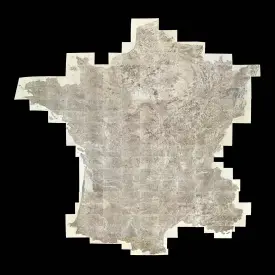
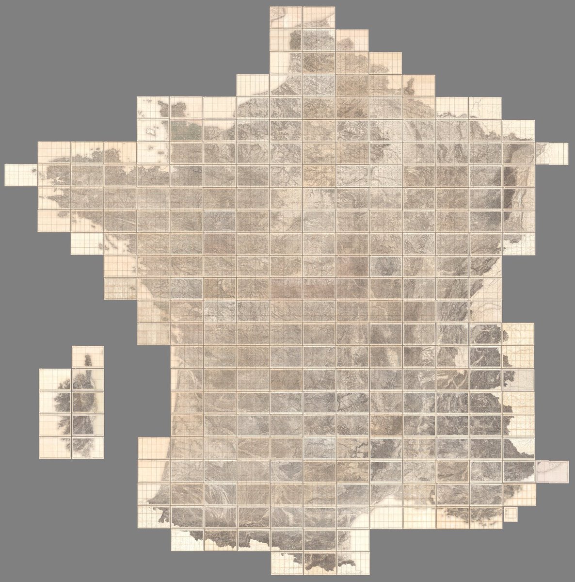
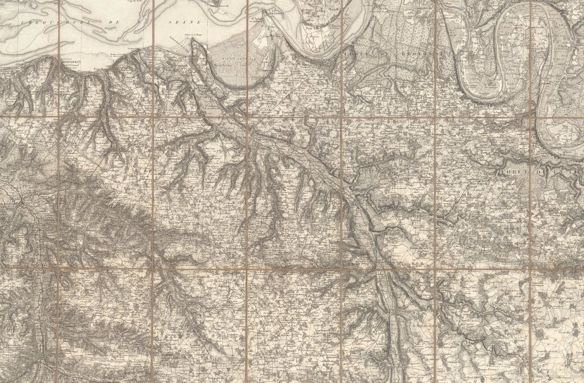
The 267 sheet Carte de France de l'État Major was produced between 1832 and 1876. At 1:80,000 scale it remains an extraordinary record of 19th century France. From city and town details to alpine glaciers, nothing is missed. A composite of all 267 sheets https://t.co/T8rqk4lBia https://t.co/TJbRUQzI1x


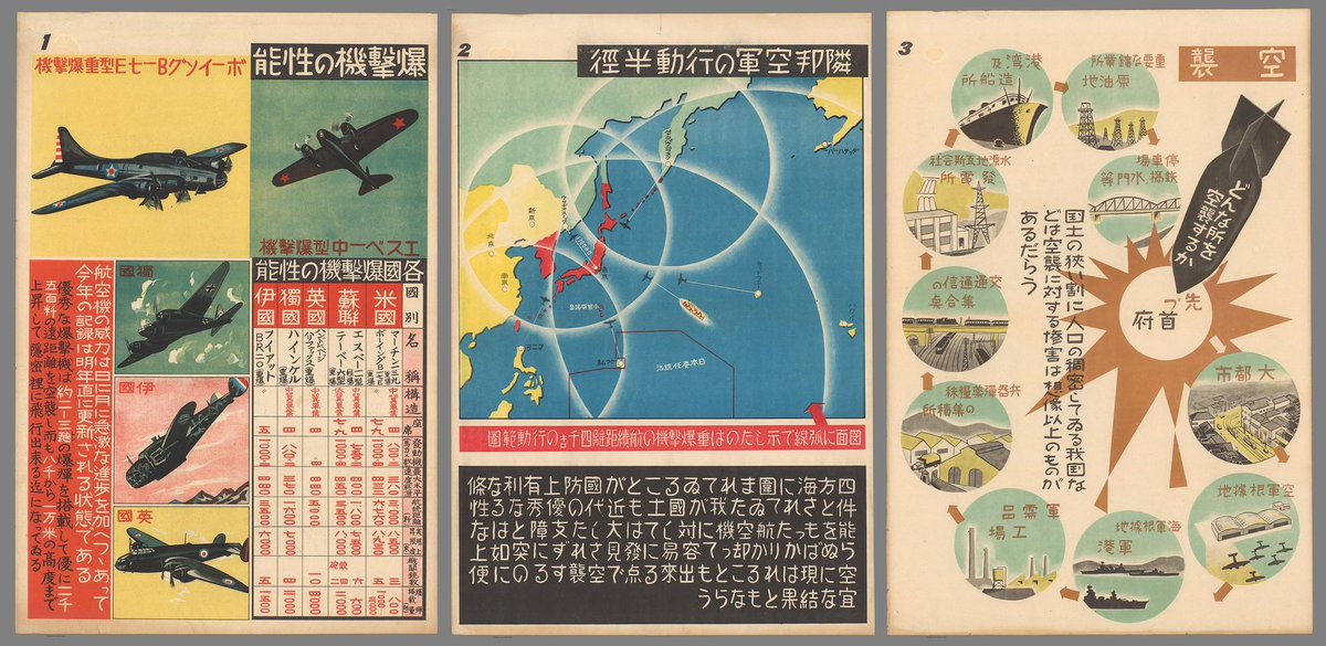
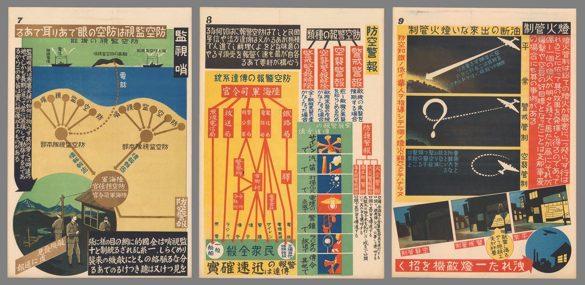
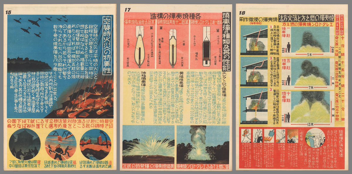
35 Japanese infographics from 1944 designed to help the public survive intense fire bombing raids by US planes during World War II. Made by the Great Japan Air Defense Association, they combine strong persuasive power through outstanding graphic design. https://t.co/utNKRLoZz7 https://t.co/KrUDYuBaml


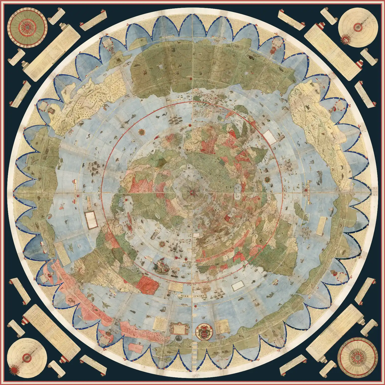 |
Largest Early World Map - Monte's 10 ft. Planisphere of 1587 An extraordinary 60 sheet manuscript world map made in 1587 by Urbano Monte has been added to the David Rumsey Map Collection at Stanford University. At 10 foot square, this map or planisphere is the largest known early map of the world. It was hand drawn by Monte in Milan, Italy, and only one other manuscript copy exists. The digitally joined 60 sheet map image below is the first time the map Monte made has been seen as one unified map - as Monte intended - in the 430 years since it was created. See all the individual sheets here. Monte's map reminds us of why historical maps are so important as primary resources: the north polar azimuthal projection of his planisphere uses the advanced scientific ideas of his time; the artistry in drawing and decorating the map embodies design at the highest level; and the view of the world then gives us a deep historical resource with the listing of places, the shape of spaces, and the commentary interwoven into the map. Science, art, and history all in one document. Until now, Monte’s manuscript map was seen as a series of 60 individual sheets. The only assembled version is the small single page key sheet of the series. Now that we have joined all 60 sheets digitally, we can appreciate in a new way the extraordinary accomplishment that Monte made. The assembled map, just over 10 feet in diameter, is one of the largest—if not the largest—world maps made in the 16th century. The degree of detail and decoration is stunning and the entire production is surely unique in the history of cartographic representation. Read Full Blog Post |
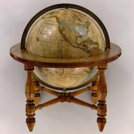
Georeferencer v4 is an improved and updated version of our prior Georeferencer v3. It allows you to overlay historic maps on modern maps or other historic maps. The overlaid maps reveal changes over time and enable map analysis and discovery. You can choose your own maps to georeference by Searching LUNA and using the Georeference This Map button or help us georeference the entire online map library using our Random Map link to georeference maps in our First Pilot Project of 6,000 maps of major cities and regions. Users who georeference the most maps will be recognized in the bar displays below. Recently Georeferenced maps can be viewed by image or by location.
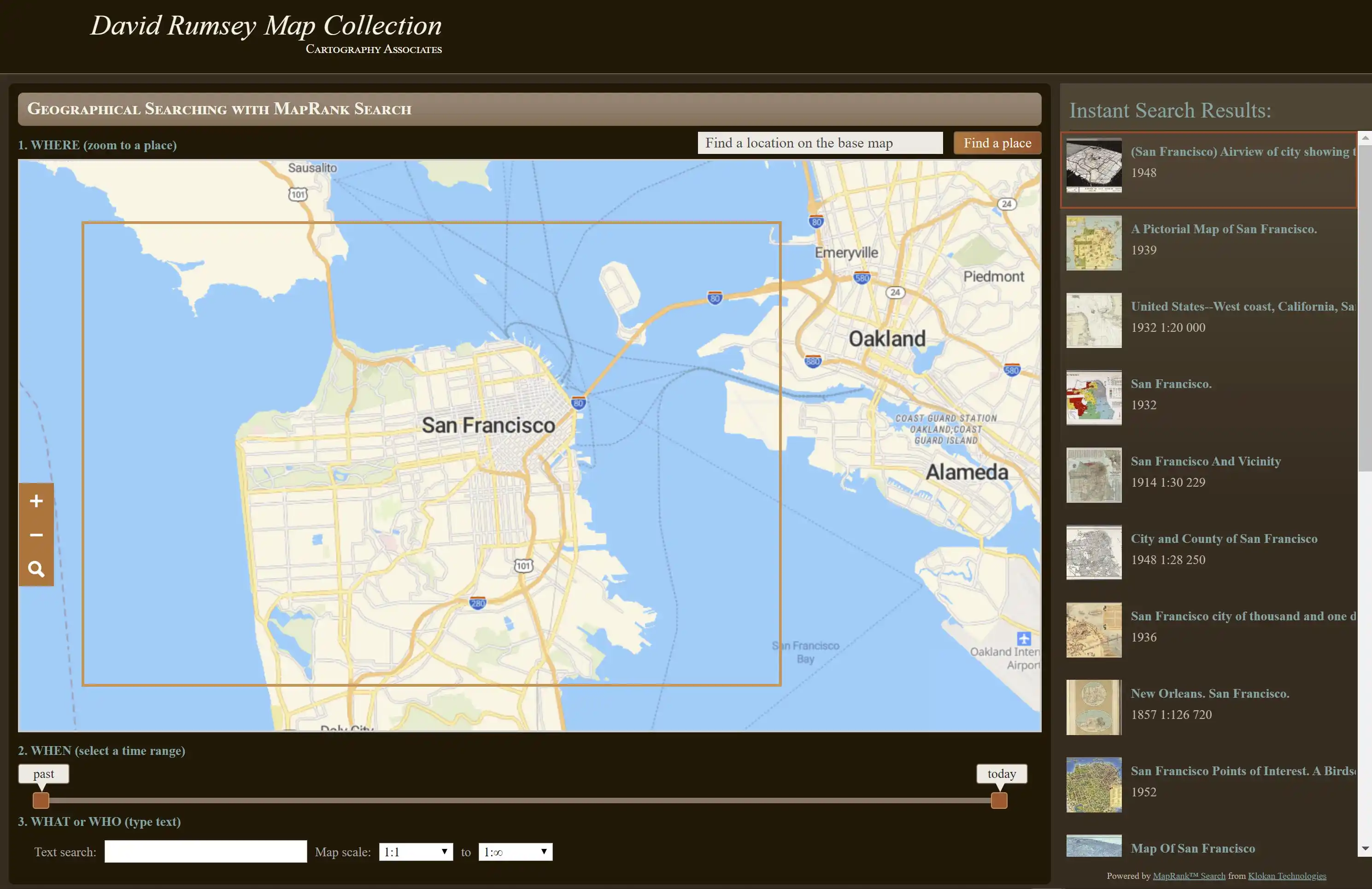
The MapRank search tool enables geographical searching of the collection by map location and coverage, in a Google Map window. Pan and zoom the Google Map to the area of the world you want maps of, and the results will automatically appear as a scrollable list of maps with thumbnail images in the right side window. The maps in the right side list are ranked by coverage, with the maps that have coverage closest to your search window listed at the top. Mousing over any map in the list will show the map's coverage as a light red rectangle on top of the Google Map. Clicking on a map in the list will open it in the Luna Browser. You can filter your results with the When timeline, the What or Who keyword text window, and the Map scale windows, as well as search by place name in the Find a place window. Learn more