trailmaps.app
Mountain biking
maps that match the trail.
Web and mobile maps that match the trail signs and official maps. Free, no account required.
Browse all maps How they work Donate
Detailed
Trail and route names, direction, parking, features, and more.
Curated
Made by someone who knows and rides the trails.
Offline
Install like an app, ride without signal.
Free
No cost.
No login.
No tracking.
The maps.
Southeast Michigan
-
Addison Oaks County Park
Leonard, MI
-
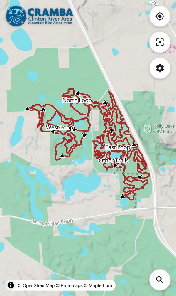
Bloomer + Clinton River Oaks Park
Rochester / Rochester Hills, MI
-
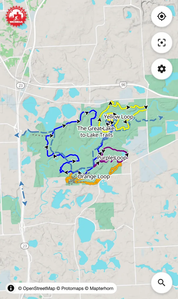
Brighton Recreation Area
Brighton, MI
-
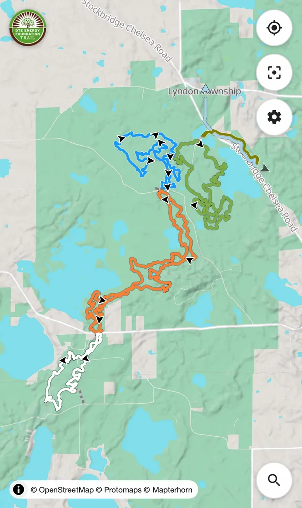
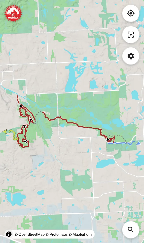
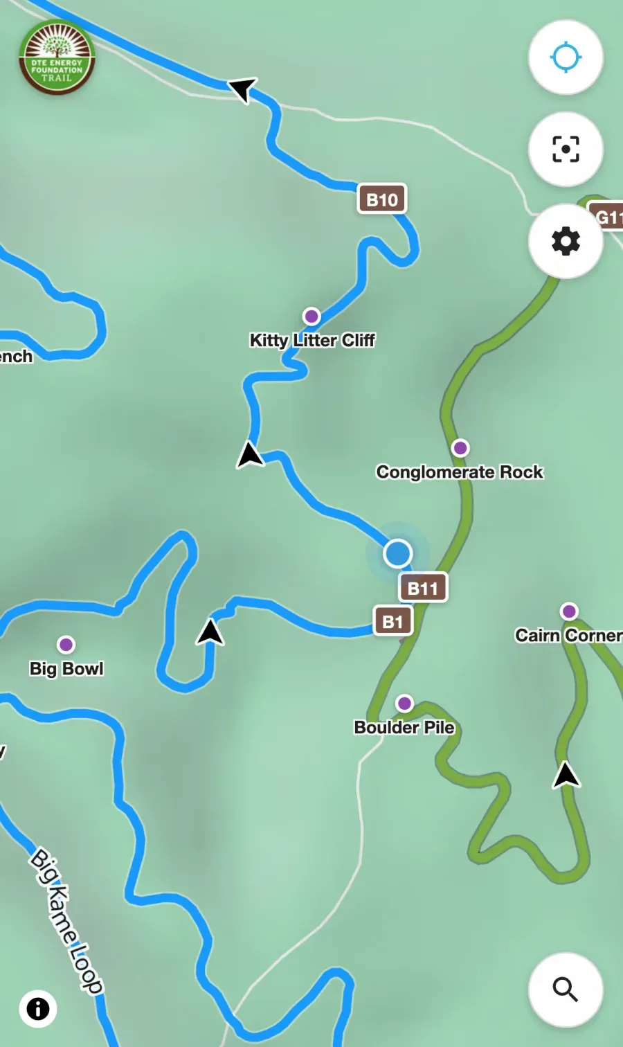
DTE Energy Foundation Trail
Chelsea, MI
-
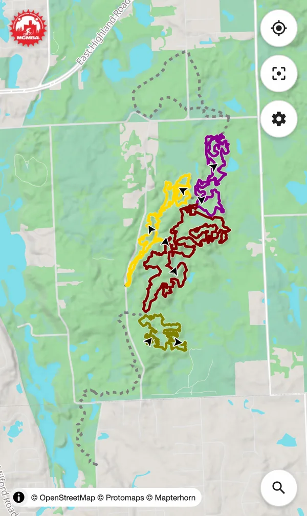
Highland Recreation Area
White Lake, MI
-
Holly-Holdridge Recreation Area
Holly, MI
-
Island Lake Recreation Area
Brighton, MI
-
Legacy Park Trails
Northville, MI
-
Oakdale Trails
Lapeer, MI
-
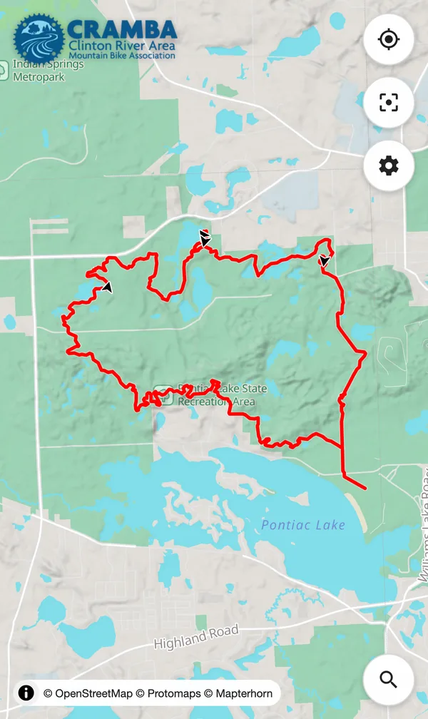
Pontiac Lake
Waterford, MI
-
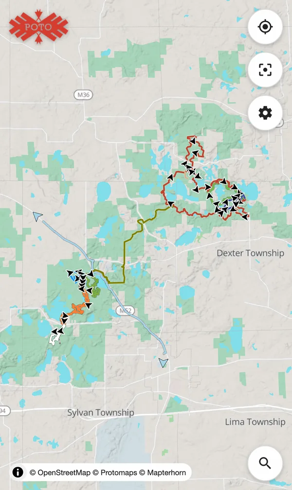
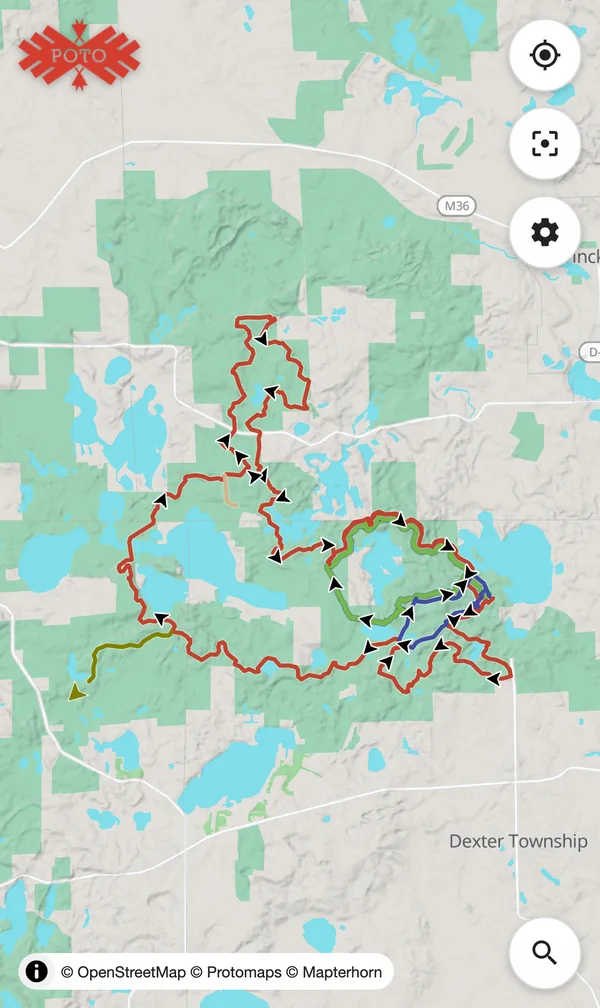
Potawatomi + DTE Energy Foundation Trails
Pinckney / Chelsea, MI
-
Potawatomi Trail
Pinckney, MI
-
Proud Lake Recreation Area
Commerce Township, MI
-
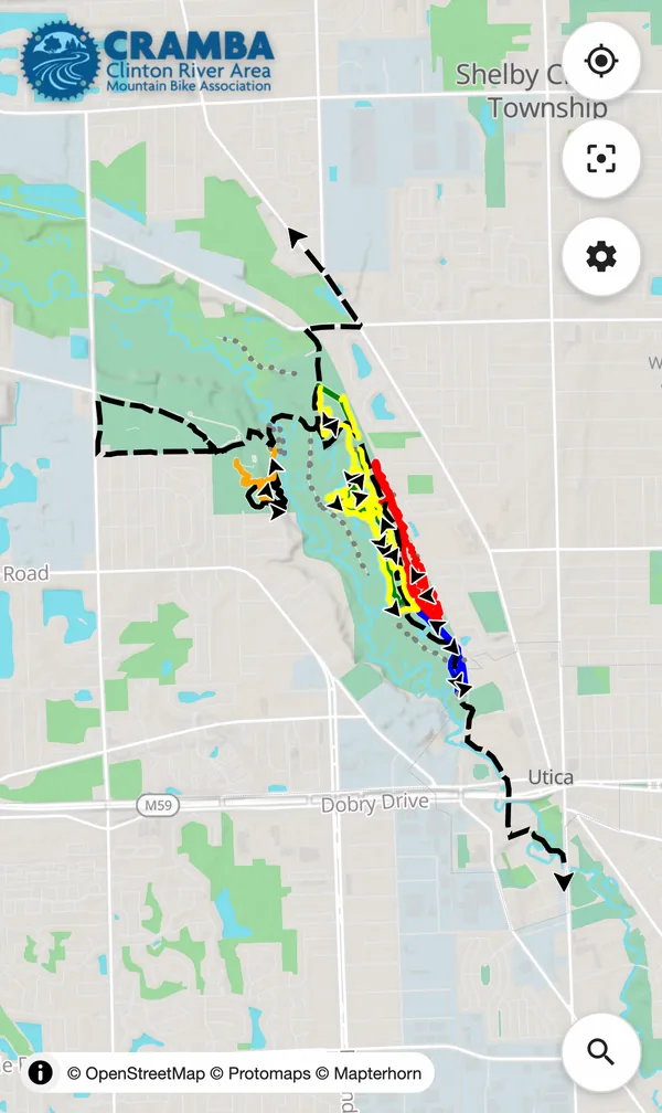
River Bends Park
Shelby Township, MI
-

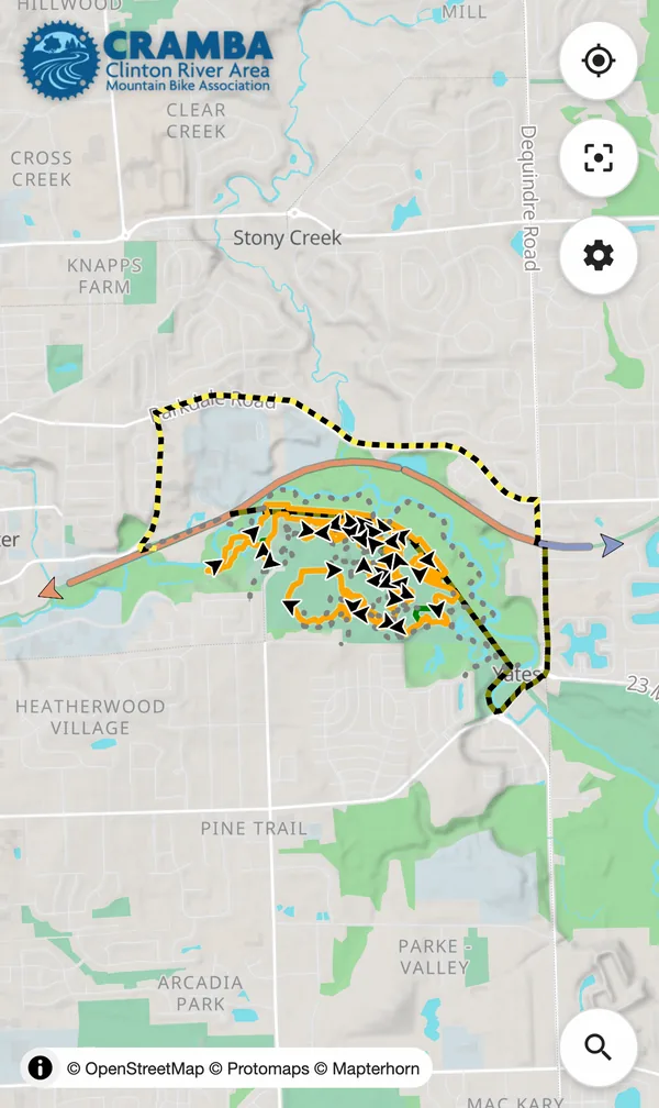
Shelden Trails at Stony Creek Metropark
Shelby Township, MI
-
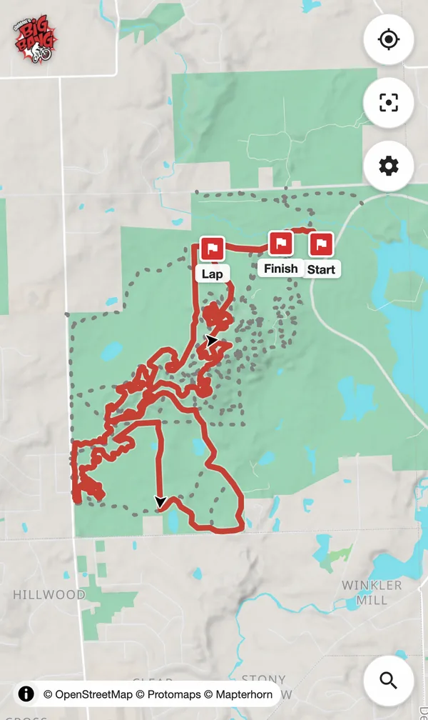
Shelden's Big Bang Race Route
Shelby Township, MI
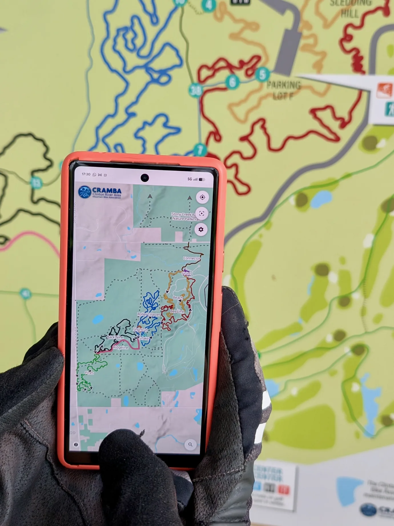
Built to use on the trail.
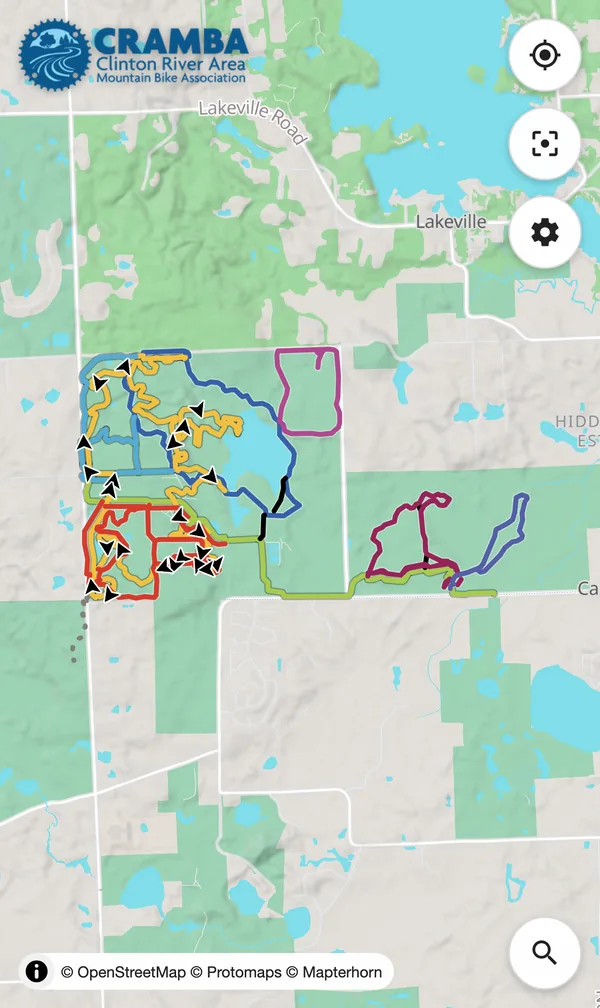
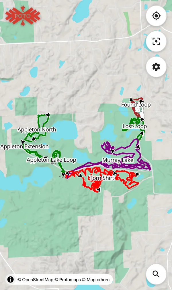
If you've used a phone map before, you've probably got this, but a few controls are worth pointing out:
Where am I?
Tap Locate to show your position. The map follows you as you move. If you pan away, the icon becomes hollow. Tap it again to resume following, or one more time to disable.
Let's go back...
Lost your place? Tap Reset to snap back to the default view.
Customize!
Open the Options menu to adjust labels, change the season, turn on or off difficulty indicators, direction arrows, trail markers, set light/dark mode, and more. (Available toggles vary by map.)
These settings are saved for the next time you load the map.
In here you'll also find a link to make the map install like an app, a view Sharing tool, and more info About the map.
I know it's around here...
Looking for that trail your friend told you about, your favorite route or feature, toilets, drinking water, or any other feature along the trail?
Tap Search to find it and the result will be highlighted on the map.
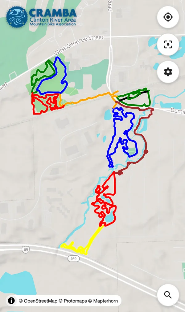
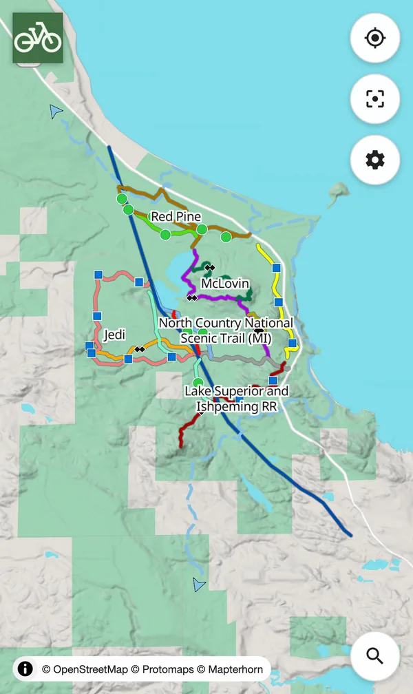
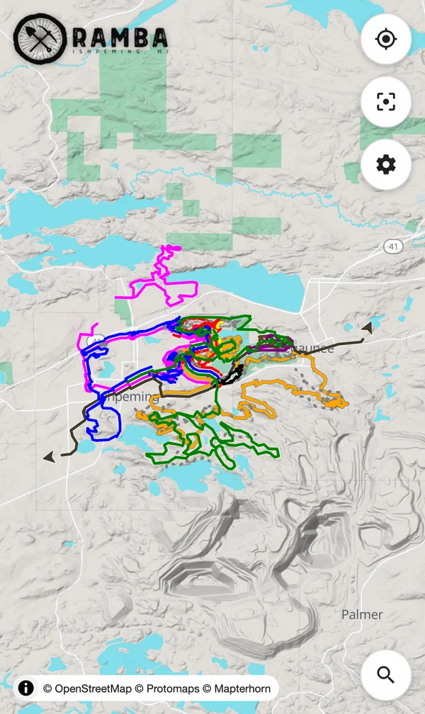
Curated, local, and styled like the trails.
Compare a Trailforks, MTB Project, Strava, Gaia GPS, or RideWithGPS view of your favorite trail to the official map. The colors don't agree, big routes are hard to see, and most of those want you to login or even pay before you can see a map at all.
Each map here is built from a snapshot of OpenStreetMap data, layered with other open data, focused on mountain biking, and styled the way the trail system is marked.
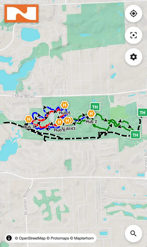
Color-matched to signage
Trail lines are styled to match the colors used on each park's signs and trail markers. The map and the post agree.
Direction arrows
One-way trails show riding direction arrows, even on alternating-direction systems. Yes, they auto-switch by day.
Winter mode
A season toggle shows winter-only trails such as groomed fat-bike loops. This is one map for the whole year.
No account required
Anyone, including visitors from out of town, can open the map and ride. No login, no paywall.
Private
No user tracking, no telemetry, no cookies. I don't watch you. These maps are built with privacy in mind.
Curated and local
Maps are reviewed by someone who knows the trail before they go live.
Static
Once a map is created it does not change until it is regenerated. For trail managers, no more surprise map changes.
Progressive Web App
trailmaps.app maps can be installed on your Android and iOS device like an app for easy access and offline use.
Hi, I'm Steve.
trailmaps.app is a personal project site that hosts maps I've made so I can share them with others. The code for making these interactive maps, PDF maps, and some of my other tools, are free. Check them out.