Outcrop — Read the rocks around you

Outcrop

3 min read Original article ↗

Point your camera at the landscape around you to learn about its geology: what the rocks are, when and how they formed, and where the continents were at the time. It also works offline.

Free, for iPhone and Android. Geologic maps worldwide from Macrostrat.

Earth’s history

See where each rock fits in Earth’s 4.5-billion-year history.

  • Cenozoic 66–0 Ma
  • Mesozoic 252–66 Ma
  • Paleozoic 539–252 Ma
  • Precambrian 4540–539 Ma

Hover over or tap the timeline to see periods and events.

Geologic maps in augmented reality

Hold your phone up to a canyon wall, a road cut or a distant ridge, and the geologic map is drawn over the landscape. The rock in the center of the screen is identified, and nearby peaks and lakes are labeled. Select a rock to highlight it and gray out everything else.
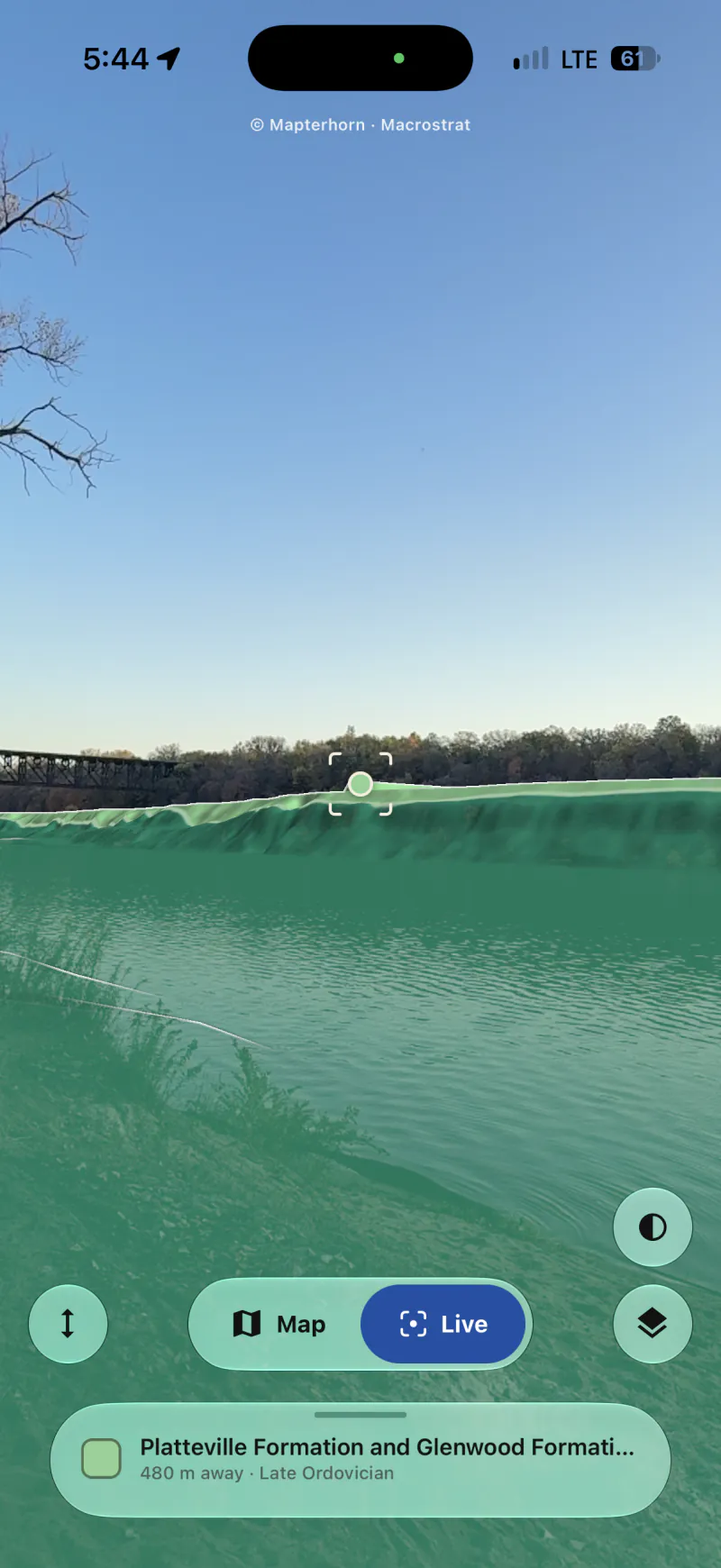
The camera view of a river, with the geologic map drawn over the far bank. The Platteville and Glenwood Formations are shown in green, and the rock in the center of the screen, 480 meters away, is identified as Late Ordovician in age.

Know what’s under your feet.

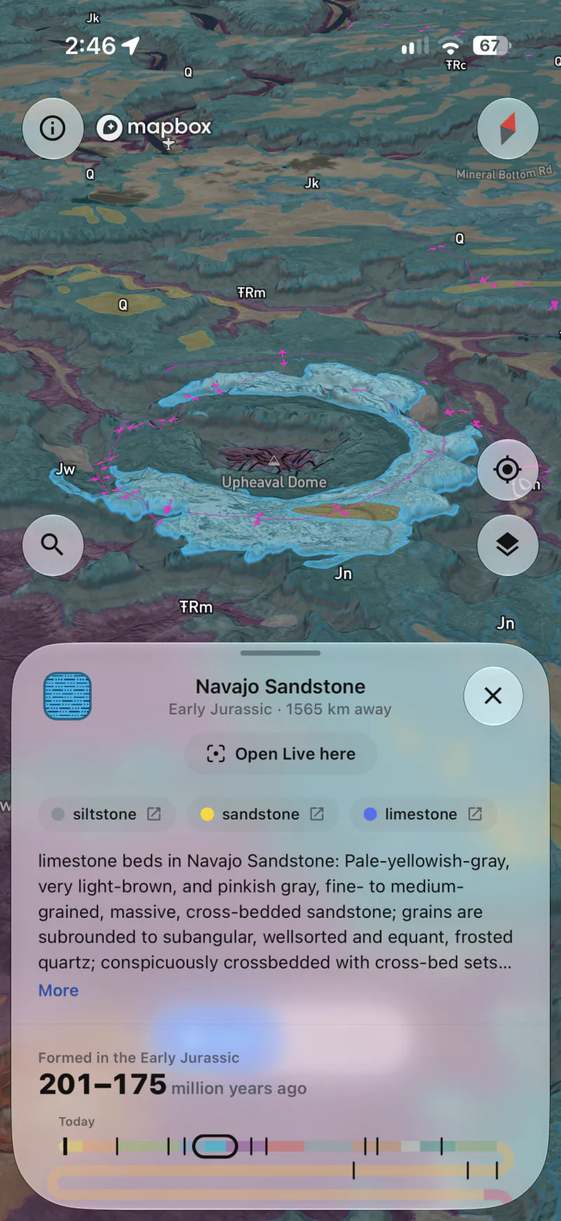
Outcrop opens to the rock you’re standing on, with its name, its age, what it’s made of and how it formed. Tap anywhere on the map to learn about a different spot.

The geologic map tilted over Upheaval Dome in Canyonlands, with the ring of Navajo Sandstone around it outlined. Below the map are the Navajo Sandstone's details: Early Jurassic, its rock types, the map's description, and its age of 201 to 175 million years on a timeline of Earth's history.

See the layers below.

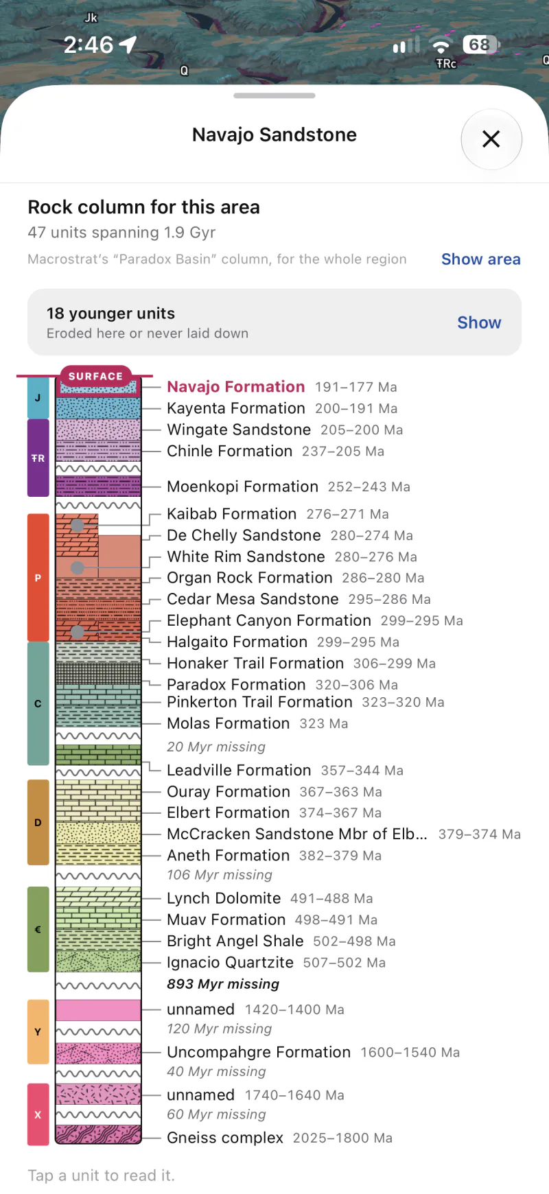
Where Macrostrat has a stratigraphic column for the area, you can see the layers beneath you from the surface down, with each layer’s age, the gaps in the record and the fossils found in them. Tap a layer to learn more about it.

The rock column under the Navajo Sandstone in the Paradox Basin: 47 units spanning 1.9 billion years, from the Navajo at the surface down through the Permian and Pennsylvanian to a gneiss complex 2 billion years old, with 893 million years missing below the Cambrian.

See where it formed.

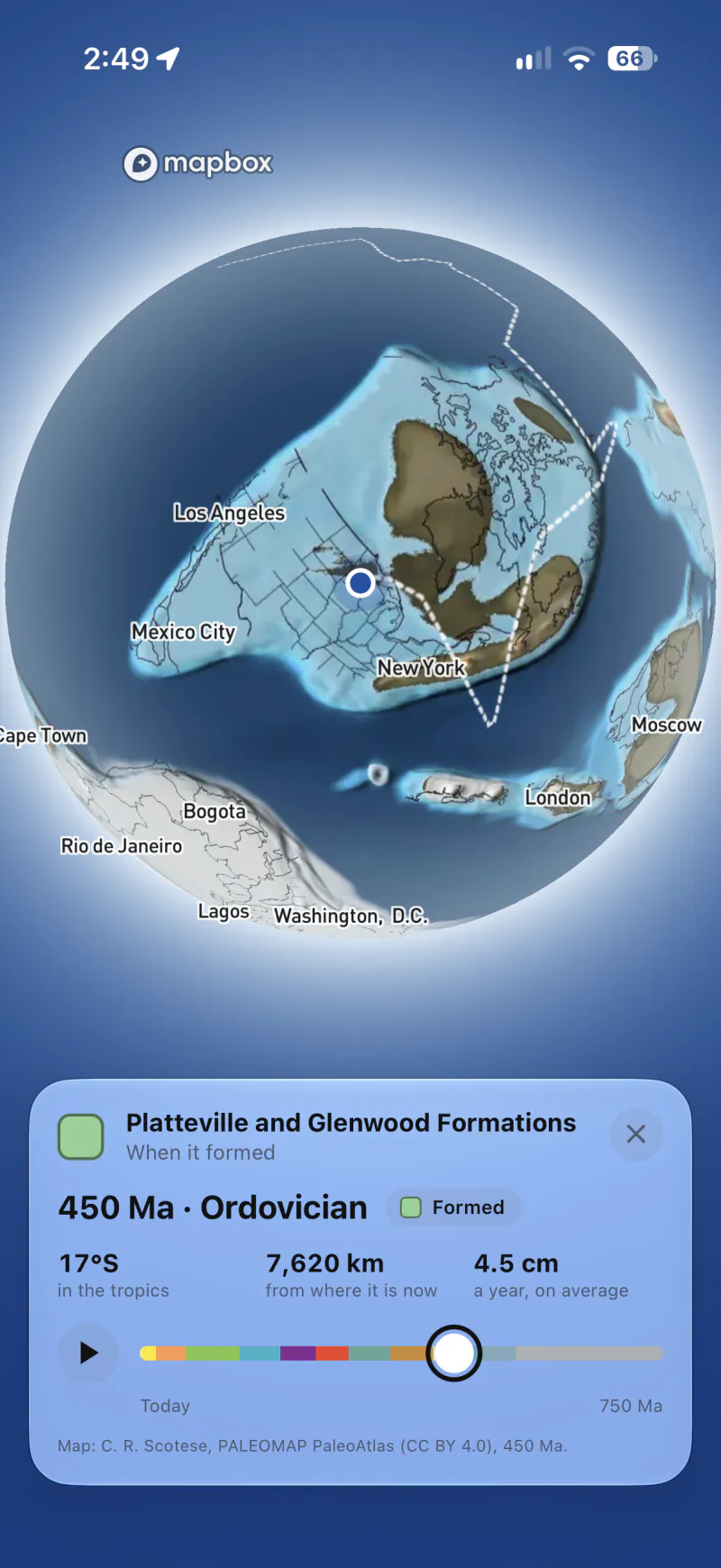
See the globe as it looked when a rock formed, using Christopher Scotese’s PALEOMAP maps. Outcrop shows where the rock was then, how far it has moved and how fast. Press play to watch plate tectonics carry it to where it is today.

The globe 450 million years ago, in the Ordovician. The rocks of the Platteville and Glenwood Formations formed 17 degrees south of the equator, in the tropics, 7,620 kilometers from where they are now. They have moved an average of 4.5 centimeters a year.

Search for rocks.

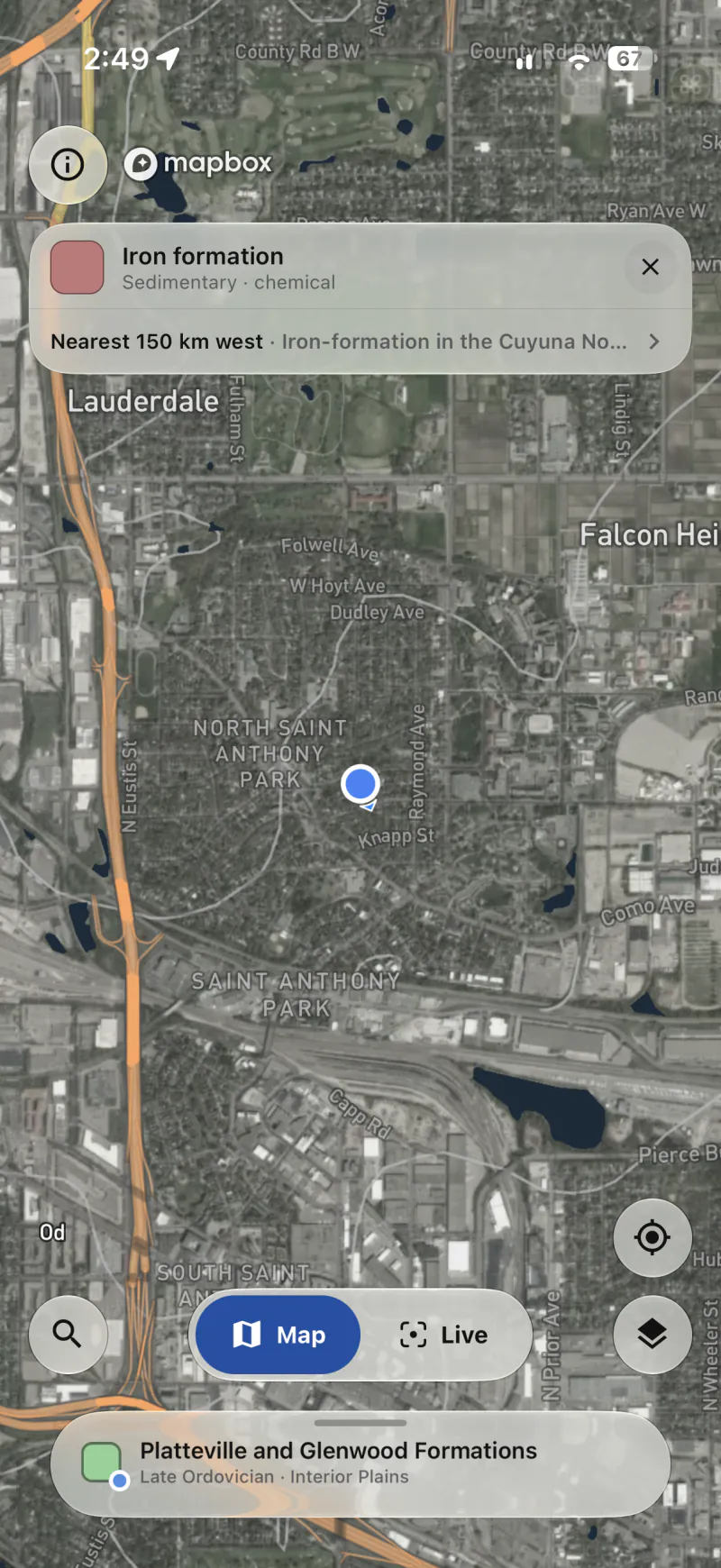
Search for a rock type, an age, a named unit or a fault. Matching places are highlighted on the map, and Outcrop tells you how far away the nearest one is, even if it’s off screen.

A search for iron formation over Saint Paul, Minnesota. The nearest match is 150 kilometers west, on the Cuyuna Range.

From bedrock to topsoil.

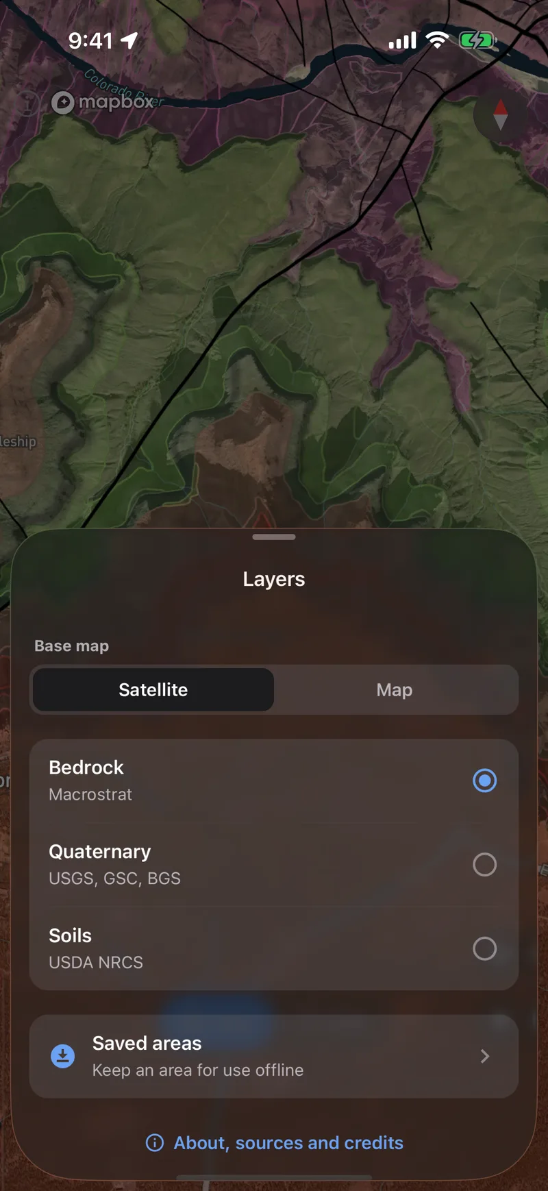
Bedrock and faults come from Macrostrat’s geologic maps, which are more detailed in some places than others. Switch to Quaternary geology to see glacial and river deposits and recently active faults, or to Soils to see the soil and the plants that grow in it. All three layers work on the map and in the camera view.

  • Bedrock and faults worldwide
  • Quaternary, active faults and soil in the US
The layer picker over the geologic map of the Grand Canyon by the Bright Angel Fault: a satellite or map base, Bedrock from Macrostrat, Quaternary from the USGS and Soils from the USDA NRCS to choose from, and Saved areas below.

Save it before you go.

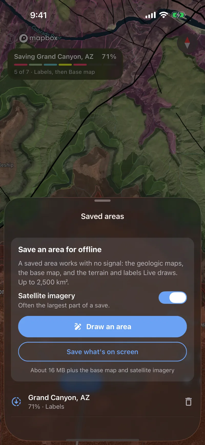
Outline an area to download it to your phone, and the map and camera view will work without a signal. Fossil records and active faults in the camera view still need a connection.

Saving the Grand Canyon for offline use: the save at 75 percent, six of its eight steps along, with satellite imagery switched on.