OpenTrailPaper is firmware for the LilyGO T5S3 4.7" E-Paper PRO. It shows ride data and offline maps, follows GPX routes, records FIT files and connects to Bluetooth sensors. You buy and protect the board yourself.
01 — Device controls
Device walkthrough
Each item shows the screen it describes. Use the orange touch target on the device to move between related screens.
02 — Optional iPhone app
Use the app for setup and file transfer.
The iOS companion can plan and transfer routes, build offline maps, copy recorded rides, change settings and install firmware updates over Bluetooth. The head unit does not need the phone during a ride.
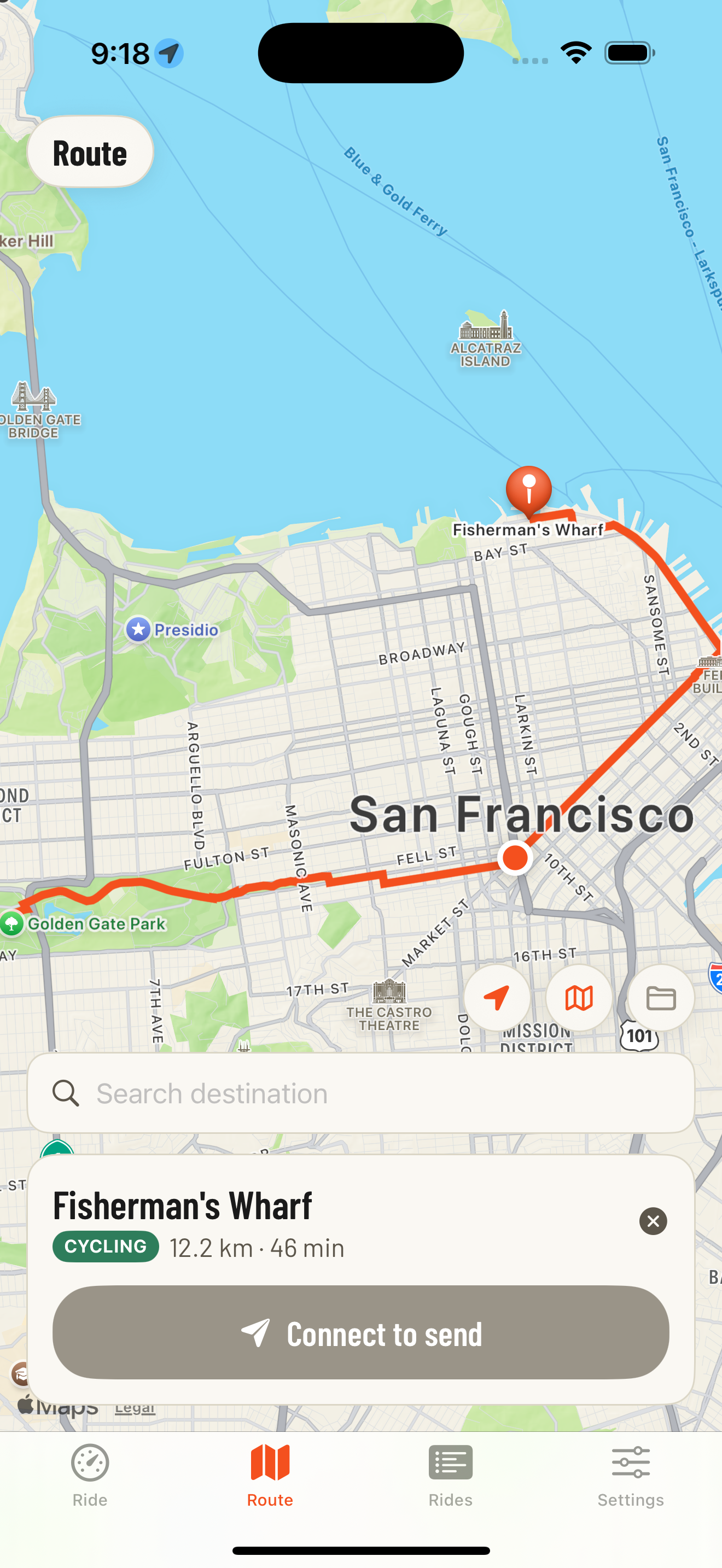
Plan a routeSearch for a destination, check the proposed route and send the GPX file to the device.
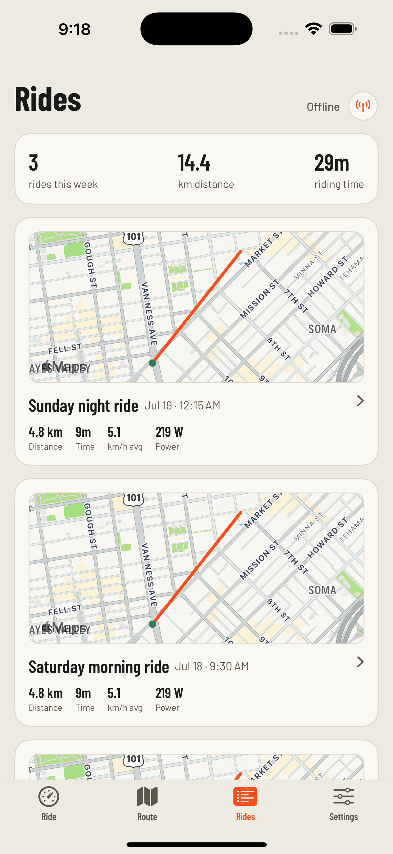
Copy recorded ridesTransfer rides from the device, then review the map, distance, power, heart rate and estimated ascent.
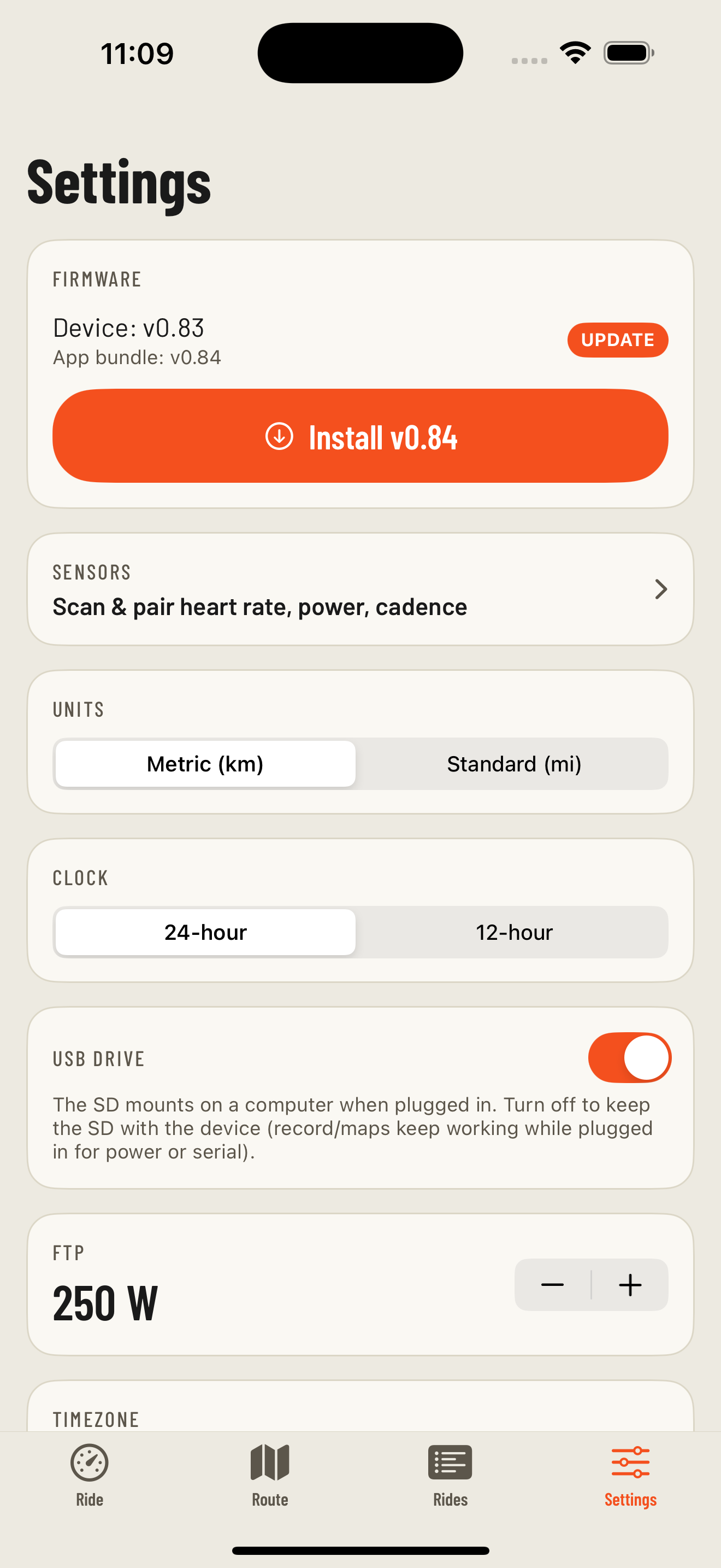
Settings and updatesSet FTP, timezone, units and backlight level, or install a firmware update over Bluetooth.
03 — Device and phone
What works without a phone
After routes and maps are loaded, the head unit can record and navigate by itself. There is no account or subscription. The app is used when you want to prepare or transfer data.
On the device — every ride
GPS tracking with speed, distance and a live map
Records each ride to a .fit file on the SD card
Turn-by-turn prompts along a loaded route
Runs structured workouts from .erg or .mrc files
Pairs with heart-rate & power sensors over Bluetooth
Works without a phone or data signal once maps and routes are loaded
In the app — setup and transfer
Plan a route and send it to the device
Build offline maps for a new area
Create workouts and arrange the device screens
Pull rides off the device and review them
Change settings and update the firmware
04 — Supported hardware
Currently supported on one board
OpenTrailPaper currently targets the LilyGO board below. It is a development project, not a finished or weatherproof retail product.
Strengths
A 4.7" e-paper panel that is readable in direct sunlight
An SD card slot for offline maps, routes, ride files and logs
GPS, capacitive touch, a front light, battery and USB-C on one board
Bluetooth 5 for heart-rate, power and cadence sensors
Firmware can be installed from a desktop Chromium browser over USB
Tradeoffs
No pressure sensor. There’s no barometric altimeter, so climbing is derived from elevation baked into the map tiles rather than measured — total ascent is an estimate.
Basic GPS. The receiver works, but a modern multi-band module would lock on faster and hold a fix better under tree cover or between buildings.
No magnetometer. Without a compass the map can only orient from your direction of travel, so it can’t point the right way while you’re stopped.
Measured baseline: about eight hours. A 1,500 mAh build ran for roughly 7.4 usable hours with the front light off. Power work is ongoing, so newer builds may differ.
Weak hardware buttons. Most interaction goes through the touch panel, which is fiddly with winter gloves or in the rain.
No waterproofing. The board ships bare with no seal or IP rating, so it needs a case or a bag of its own before you ride it in the wet.
Got a better board in mind?
Suggestions and pull requests welcome
Help wanted
A better target board would include a barometric altimeter, multi-band GPS, magnetometer, larger battery, usable hardware buttons and a weatherproof case. If you know of one, open an issue. Board ports are also welcome in the source repository.
Have the hardware?
Install the firmware and prepare an SD card.
The setup page flashes the board over USB and can build basic offline maps. It requires a desktop Chromium browser; the iOS app produces maps with elevation data.