Earthquake in Japan yesterday may have shifted land 1.3 meters
www3.nhk.or.jpAustralia updated its latitude and longitude somewhat recently because of continental drift:
> The Geocentric Datum of Australia, the country’s local coordinate system, was last updated in 1994, and Australia is now about 1.5m further north-north-east (or, to give the metric used in a BBC infographic: about the height of a kangaroo).
* https://www.theguardian.com/science/2016/aug/03/mind-the-gap...
* https://www.ga.gov.au/scientific-topics/positioning-navigati...
* https://www.australiangeographic.com.au/topics/science-envir...
To anyone working in the GIS industry: how would one go about doing a 'mass update' of locations of an entire country in maps and firmware and such?
I'm also curious if anyone has a good article to read on how this is managed. My guess would be that you have reference points and sets of nearby things that are recorded relative to the closest reference point. As noted in the sibling, your plat map is likely set against a local landmark. (Though, even there, they often also include the lat/lng of where it is expected to be found.)
This is a good example of why capturing coordinates in a local spatial reference system may be better than capturing coordinates in a global spatial reference system.
Global coordinates of a place of interest will drift relative to a global coordinate system but remain stable relative to a local coordinate system. This article illustrates that "stable" is not the same thing as unchanging in the presence of 7.5 earthquakes.
It’s similar to capturing future dates in local time including timezone. There’s no guarantee that 1300 london time on 20-Dec-2029 will be 1300UatC, as the U.K. may shift its daylight rules before then.
That depends entirely ok whether the event being reflected is local or global. If its the time of an solar eclipse, for example, then its unaffected by daylight rules - unlike business hours and such. Working with dates/timestamps is a nightmare, but appears simple at first blush.
Australia’s geocentric datum is pretty boring, because Australia’s tectonics are pretty boring. We just don’t get large earthquakes. So the GDA94 → GDA2020 update is actually pretty minor.
If my understanding is correct, the 1.8m difference sometimes talked of between ITRF92 and GDA94 by 2020 is actually irrelevant so long as you do proper projection of your coordinates, which you should, but some things don’t—and so tweaking your reference point from time to time to compensate is pragmatic (in part because it lets people skip deformation models where a metre or so of accuracy is adequate, so temper my “should”). The GDA94 → GDA2020 update is more about certain changes in ITRF1992 → ITRF2014 (~9cm changes in ellipsoidal heights), and local crust deformations. Mass updating from GDA94 to GDA2020 is an easy reprojection.
In saying GDA94 is actually fine as far as continental drift is concerned: the thing most people don’t realise is that all of these coordinate systems are actually time-dependent transformations: they’ve got forecast continental drift baked in. So later datum updates just need to record what actually happened, if it was different enough (which it will be in places).
Now real earthquakes—they make things much more interesting. I like what https://www.linz.govt.nz/guidance/geodetic-system/coordinate... says:
> Some earthquakes, such as those of the Canterbury earthquake sequence starting in 2010, have caused metres of movement. Where this has happened we have updated the coordinates rather than simply include the movement in the deformation model. This is necessary as otherwise the coordinates will not be accurate enough for many applications. The deformation model still includes the earthquake deformation, but it is applied in reverse to transform coordinates for dates before the earthquake.
The deformation model page <https://www.linz.govt.nz/guidance/geodetic-system/coordinate...> is also rather interesting, giving details of when they’ve released new deformation models, including both forward and reverse patches due to earthquakes, and it’s messy. I haven’t thought too deeply about the reverse patching technique (this isn’t a domain I work in) but I don’t think I like it (though it may be pragmatic) because it messes with epoch-era NZGD2000 points, seems to undermine the purpose of a datum unless you have recorded the coordinate times as well (rather than merely transforming to the epoch, which has now been spoiled). Did have a fun chat with a telecommunications field worker that I happened to meet when I was in New Zealand in 2021, who had a lot of interesting experience after the 2016 Kaikoura earthquake. Lots of stuff I’m not used to thinking about, coming from boring old Australia.
Hi from New England, middle-of-the-plate buddy. In fact, it had never occurred to me that the mapping of parts of the ground to, like, latitude-longitude could be time dependent, haha. I guess this could make a big difference in surveying.
Latitude-Longitude are references within a CRS (Coordinate Reference System).
US mapping can be based on USNG (United States National Grid) which is a cartesian geometry reference system, and if the entire USA moved a meter to the east, you may find that your USNG coordinates do not change at all.
The most common CRS is called WGS84, as this is the reference CRS for GPS. If the USA moved a meter to the east, the WGS84 coordinates would change.
There's a field of study devoted to translations between different coordinate reference systems, projections, geometries and more – and that's before we even get to mapping Mars or the Moon!
Geospatial definitions have a similar delight to date definitions, in that any and every reference could be annotated with "It depends" :-)
For most surveying wouldn't the the relative, nearby points be shifting together equally?
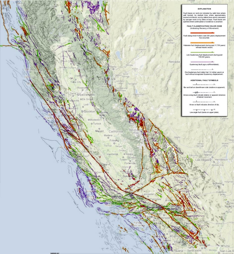
not in California, Iceland, or Japan!
It’s unlikely the relative position of Griffiths Observatory and the Chinese Theatre would change though, both may shift north by 74cm relative to Las Vegas sure, but I’m not aware of any faults between those two points
Falsehoods programmers believe about landmasses.
Locations inside a country (e.g. plat map boundaries) don't use latitude/longitude.
Some places use an encoded lat/long.
Open Location Code - "Google has shown practical usage of plus codes for addressing purposes in Cape Verde,[10] parts of Kolkata[11] and Kolhapur[12] in India, and the Navajo Nation in the United States.[13]" - https://en.wikipedia.org/wiki/Geocode . https://freethoughtblogs.com/singham/2023/12/24/using-olc-co... says a friend of his sent an OLC coordinate to get to a place in Carmel-by-the-Sea, California, which (infamously?) has no street numbers.
What3words - "This population had "no consistent addressing system" until May 2016 when Mongol Post started using a geocoding system provided by what3words." - https://en.wikipedia.org/wiki/Mongol_Post
Over time (centuries?) the named coordinate will no longer be valid as the location is no longer near enough to that lat/long.
I believe W3W are 1m squares, so in Japan it sounds like they may be already broken
https://en.wikipedia.org/wiki/What3words says "What3words divides the world into a grid of 57 trillion 3-by-3-metre (10 ft × 10 ft) squares".
Australia moves about 7cm/year so after about 43 years a W3W coordinate no longer matches local coordinates.
It feels weird that a continent could move so much in someone's lifetime.
Looks like the 1906 San Francisco quake had displacements up to 8.5 meters, so more than two squares. https://en.wikipedia.org/wiki/1906_San_Francisco_earthquake
They didn't used to. And, of course you are correct that survey markers are to landmarks. But, more and more people are using data from online mapping services, that largely think they can store locations in lat/lng. People seem to trust that as "the UTC of location data."
That said, those can be just as fraught, no? Since movement will not be fully uniform for the entire continent? And landmarks aren't static things, either? I'm curious how landmarks are done to preserve this, long term?
> And landmarks aren't static things, either? I'm curious how landmarks are done to preserve this, long term?
At least in the US, the people in charge of this (the National Geodetic Survey) take movement into account. This[1] is the datasheet for the reference monument nearest my house. It has data for 3D velocity of the reference point.
I'm not sure what the difference is between VX/VY/VZ and northward/eastward/upward, but those numbers are bigger than I thought they'd be. 15 mm/yr seems like a lot!VX = -0.0150 m/yr northward = 0.0040 m/yr VY = -0.0008 m/yr eastward = -0.0148 m/yr VZ = 0.0030 m/yr upward = -0.0002 m/yrThe official coordinates get updated from time to time, and in-between, perhaps you're supposed to adjust your measurements using that movement data (IANAS)? If there is a significant measured change in location due to an earthquake, I'm sure that data would be included in the monument datasheet or a new set of coordinates would be published.
FWIW, I went looking to see when the last earthquake was here in Maryland and it turns out there was one today[2].
[1] https://www.ngs.noaa.gov/cgi-cors/CorsSidebarSelect.prl?site... [2] https://www.abc27.com/news/top-stories/2-3-magnitude-earthqu...
The amount of energy released in such events boggles the mind. Shifting cubic-kilometers of rock, in this case several hundred or even thousands of cubic-kilometers, even a few inches requires more energy than all the worlds nukes many times over. We live atop an immense heat engine, every little vibration of which could power our entire civilization for years.
I've always found it fascinating that geophysicist and earlier advocate for Bayesian methods, Sir Harold Jeffreys, didn't believe in continental drift and plate tectonics because he felt there was no known source of energy on the Earth massive enough to explain this movement. [0]
He remained an opponent until death (at which point continental drift was widely accepted) which is both a testament to the literally unbelievable energy behind seismic activity and the importance of updating your Bayesian priors as you gain new information.
0. https://en.wikipedia.org/wiki/Harold_Jeffreys#Opposition_to_...
Another great illustration of Planck’s law:
> Max Planck, surveying his own career in his Scientific Autobiography, sadly remarked that “a new scientific truth does not triumph by convincing its opponents and making them see the light, but rather because its opponents eventually die, and a new generation grows up that is familiar with it.“ -The Structure of Scientific Revolutions
This is actually such a great insight. That's why we also need new generations of politicians and management every so often to keep the wheel of progress rolling. And, incidentally, why I think that developing anti-aging technology is not a good idea.
I wonder if there's something physical to do with aging that makes people cognitively inflexible. Anti-aging tech would be great if you could prevent that negative aspect of aging too.
Actually the lesson I take away is the importance of not having a 0% (or 100%) prior, since it leaves no room to update with new information.
It is also suspicious because it means someone has assigned a 0% prior to their being insane or in some sort of Plato's-cave scenario - which is hard to justify.
The minimum possible Baysian prior is a base rate of "my senses are just not picking up reality and/or my memory is catastrophically compromised and/or I cannot process logic right now due to some reason" which while low is never going to be 0%. There are too many known ways for human brains to fall over. 0% priors are unjustifiable.
I've always found it fascinating that the guy who came up with the theory (Wegener) died in on the ice sheet in Greenland while attempting to resupply a research station. Having spent some time on the Greenland Ice Sheet at Summit Station, life on the Greenland ice sheet is much more cushy nowadays...
I think we sort of have the tech to use geological energy, but I imagine the hardest part is not having your equipment destroyed all the time by quakes? You'd probably want to put your collectors deep underground where there's more activity
At a theoretical level, it could be done with ropes. You don't need to wait for earthquakes. Setup two anchors on either side of a fault. String ropes between them. As the two plates slowly more, the stretching ropes can be tied to generators. Totally theoretical but, no new physics is required to extract energy from two slowly moving things.
It's even harder than harvesting lightnings.
A friend, back when he was a physics student, looked into harvesting lightning.
He calculated that it wasn't economically viable: tons of wattage, but for such brief timespans, that it doesn't actually amount to that much on a comparative scale. The cost of building the collectors and transporting the electricity (from ocean platforms) was much higher than the cost of using other energy sources. Iirc. It wasn't exactly a serious investigation by a team of engineers, but I basically trust his conclusion.
Maybe it will be more attractive in the future after we stop using hydrocarbons?
I know embarrassingly little about electricity, but wouldn't this also likely require significant advances in semiconductors to even be feasible?
I'm not sure about that. Drill some holes, pump some water, and geothermal power straight to the grid can be done. Harvesting lighting would require innumerable towers and even would require some trickery to get it hooked up to our power grids.
That’s not kinetic earthquake energy, though.
I think in an apples-to-apples comparison, you would need to attach some kind of device to absorb the kinetic energy from the fault.
A building-sized piezo crystal?
Country sized.
Or one clock tower and a flux capacitor...
...and wait for the next major earthquake to even test it.
For starters, the scythe keeps melting
Out There Learning - The Greatest Ever On-Land Fault Movement - https://youtu.be/LUsIIJwxPYU (length: 4m 25s)
> Where is the world's greatest known on-land fault movement of any individual earthquake? It's at a place called Pigeon Bush near Wellington New Zealand. It is the surface trace of the Wairarapa Fault. In 1855 a magnitude 8.2 earthquake offset a small stream bed by about 18.5 metres which is the greatest single-event fault movement of any on-land fault in the globe!
How property rights work when land shifts?
An example for Alaska.
https://storymaps.arcgis.com/stories/662519e4406946faa6e655d...
> Land within the Refuge that is tidally influenced up to the mean high-tide level, is managed by the Alaska Department of Fish and Game (ADF&G) for its unique recreational and wildlife values. As post-glacial rebound lifts the outer edges of the Refuge beyond the reach of the tides, the Refuge boundary shrinks. --->>> When glacial rebound lifts this new land above the high tide line, landowners adjacent to the Refuge can go through a legal process to claim this new land as a part of their property. <<<--- To ensure that these uplifted lands remain in their natural condition for habitat and recreation, the Southeast Alaska Land Trust (SEALT) sought partnerships with interested landowners through the Accreted Lands Project.
And on the wiki page for post-glacial rebound, Finland has an example: https://en.wikipedia.org/wiki/Post-glacial_rebound#Legal_imp...
> In areas where the rising of land is seen, it is necessary to define the exact limits of property. In Finland, the "new land" is legally the property of the owner of the water area, not any land owners on the shore. Therefore, if the owner of the land wishes to build a pier over the "new land", they need the permission of the owner of the (former) water area. The landowner of the shore may redeem the new land at market price.
In California, you file an action in court and they will redraw the property lines in a fair manner, allowing everyone affected to have a say in what counts as "fair".
https://law.justia.com/codes/california/2009/ccp/751.50-751....
As I understand it (at least in the US), your land rights are based off of relative measurements from a static (to the land) point. They often look like medallions on the ground, anchored in place by fairly sizable stakes to ensure they don't easily move.
The positions of those medallions... not as sure, but I imagine they are in turn positioned according to other static points.
If the land cracks, well, I have no idea. That would be a legal battle no doubt.
EDIT: These fixed points are called "common points" or "points of beginning (POB)", and there's usually one per neighborhood. There are also apparently buried iron rods (survey pins) that define property lines that can be found using a metal detector or such, but they are not foolproof.
Reminds me of this marker story: "Belgian farmer accidentally moves French border" [1]
The more common points are called trigonometrical points or triangulation stations.
https://en.wikipedia.org/wiki/Triangulation_station
https://en.wikipedia.org/wiki/Point_of_beginning
(I'm surprised there's no link between these two articles.)
In Japan property boundaries are (often) marked with physical markers embedded into the ground: https://www.japantimes.co.jp/community/2015/01/02/how-tos/pr... https://japanpropertycentral.com/real-estate-faq/land-bounda...
Survey spikes are common worldwide. The issue is that they are not always where you think they would be. They are positioned relative to each other, were placed years ago, or moved by unscrupulous land owners. And until relatively recently it was all done by one person using an optical device looking at another person standing there with a colored stick.
Surveyors are often called to resolve any discrepancies during disputes or sales.
Land could grow or shrink. I'd think split the difference.
Related:
Magnitude 7.6 earthquake strikes Japan, tsunami warning issued for Ishikawa - https://news.ycombinator.com/item?id=38830281 - Jan 2024 (64 comments)
4' in Freedom Units. I'm wondering how well utilities and megastructures on the Noto Peninsula are able to cope with gradual and sudden shifts, even in Japan where earthquakes are assumed. It looks like Noto is being ripped and stretched NW from the mainland.
---
Also, I re-read the Fukushima Daiichi report summaries yesterday. It's an almost universal human condition that plays out again and again: corporate risk management for large projects is done improperly, especially when there are constraints and cognitive dissonance imposed by the business culture, and it leads to a major failure.
Points of the failure chain include:
- Failure to account for known unknown risks such as the land subsidence combined with a large tsunami (based on the coastal geomorphology of the specific site).
- Failure to protect critical EDGs from flooding, e.g., seawater intrusion. If trying to run a diesel motor near the ocean, it must be buttoned-up tighter than a Jeep with a snorkel including waterproofing sensors, wiring, and control systems. In general, sites should be chosen on very high ground with a large safety factor. If that's not possible, they should be placed on elevated, reinforced structures.
- GE BWR-3/-4 (Mark I) core design is such that they can overheat and self-destruct, even if scrammed, because cooling is an absolute requirement at all times.
- A lack of redundant, auxiliary, passive cooling ability, such as a gravity-fed reservoir that can be operated manually.
- Regulators did insufficient due-diligence to prevent these risks.
- "Made in Japan" failure of culture (this was part of the final report).
- Using radionuclides that are inherently dangerous and produce forever waste rather than cheaper alternatives like solar with PES. Japan's solar just overtook nuclear, but still relies heavily on coal and gas. BWRs are inherently nastier than PWRs.
Non-problems at FD:
- Scramming worked properly, but the primary loops were still hot.
Disclaimer: Worked in the nuclear industry where hostnames were Simpsons' character names.
This is a very sad example of land movement and it's a tragedy that people have died in the aftermath and recovery effort.
But it's also an important reminder that our super accurate GPS measurements are not 100% reliable over time. The earth moves. Either in jumps like this or fairly constantly if it's somewhere like Australia [0]
0 -https://www.nytimes.com/2016/09/24/world/what-in-the-world/a...
> our super accurate GPS measurements are not 100% reliable over time
The GPS measurements are 100% reliable. Think of it like getting GPS co-ordinates while on a boat - it's the boat that moves.
A point of interest on land doesn't stay at the same latitude/longitude/altitude because land is a tectonic plate "boat" floating on the mantle.
Close to the earthquake faultplane, land crumples and shears sideways and up/down. Plus secondary effects of the shaking: landslides, settlement, liquifaction.
Finally: I think it helps to remember that earthquakes are fault _planes_. Talk of epicentres and depths and faultlines often misleads our intuitions. For one of the Christchurch earthquakes my parents were about a kilometre away from the faultline (where the faultplane met the surface) and many kilometres away from the epicentre (which is just a synthetic average point), but the faultplane actually was relatively close to them somewhere underneath their home.
Also images of cracks in roads are often extremely misleading. They tend to be spectacular subsidence and are not the faultline. The actual faultline is usually not so photographic and less likely to have great photos early on. Media choses photos for their emotional appeal - not because they are a good approximation for the truth.
> The GPS measurements are 100% reliable. Think of it like getting GPS co-ordinates while on a boat - it's the boat that moves.
I'm not sure this is a good metaphor. When doing high-accuracy GNSS (GPS) survey work, a static reference station is typically used to help correct errors from the GPS measurements themselves.
If GPS was 100% consistent and reliable, differential correction wouldn't be a common and often-required technique:
While you’re correct that GNSS is not 100% accurate (like everything in the physical world, it comes with error bars), I think the point stands that the error is unrelated to the movement of continents.
Ultimately GNSS is just measuring your position relative to some celestial objects using the time it takes for signals to propagate space (and some other info: their ephemerides, and a shared-ish clock). The fact that land exists, and where it exists, are not relevant
Your error corrections might be thrown off when the base station moves, but that’s not an issue of GNSS that’s an issue of RTK
GNSS satellites talk to base stations on earth to get correction data using the measurements they obtain (including measurements obtained by tracking satellites from the ground). I believe this is what the poster above is reffering to.
RTK is a whole another beast and the meaning of an RTK base station is something else.
RTK is exactly what I was referring to.
I'm confused, how does moving 2.7 inches a year translate into 656 feet over 25 years? Was it moving tens or hundreds of times faster a few decades ago?
Basically, before 1994 the official Australia coordinate system was not optimized for GPS, which was not common when the system was developed, and so didn't exactly align with global coordinates. The 656 foot change was mostly about that, not about tectonic changes.
AGD is Australian Geodetic Datum of 1984 and GDA94 is Geocentric Datum Of Australia 1994.
> The AGD provided a reference system that best fit the shape of the earth in the Australian Region but its origin did not coincide with the centre of mass of the earth. National datums were commonly non-geocentric before satellite based navigation systems were established in the early 1970’s. The distance between the origin points of GDA94 and AGD is approximately 200 metres. When the coordinates of a point on the Earth’s surface are converted from AGD to GDA94 this translates to a coordinate difference of approximately the same amount. The difference varies slightly depending on where you are in Australia.
- https://www.icsm.gov.au/datum/australian-geodetic-datum-1966...
> Previously, a change of about 200 metres occurred in the year 2000 when Australia shifted from the Australian Geodetic Datum 1984 (AGD84) to the Australian Geocentric Datum 1994 (GDA94).
- https://www.dmp.wa.gov.au/News/Geocentric-Datum-of-Australia...
Nowadays you can use the Australian Terrestrial Reference Frame, which is time dependent and automatically adjusts to compensate for tectonic movement: https://www.icsm.gov.au/australian-terrestrial-reference-fra....
I assume that should be 6.56 feet or some similar miscalculation converting from metric to imperial measurements
> 6.56 feet
Statute feet or survey feet?
* https://www.nist.gov/pml/us-surveyfoot
* https://oceanservice.noaa.gov/geodesy/international-foot.htm...
* https://en.wikipedia.org/wiki/Foot_(unit)#U.S._survey_foot
Or Swedish feet (29.69 cm), perhaps an Amsterdam foot (28.3133 cm)?
Perhaps make it half and half (and undocumented) so that neighbours can embark on generational land feuds.
https://en.wikipedia.org/wiki/Swedish_units_of_measurement#O... https://en.wikipedia.org/wiki/Dutch_units_of_measurement#Voe...
> But it's also an important reminder that our super accurate GPS measurements are not 100% reliable over time. The earth moves.
This is IMO an odd statement. Land moves, and we can measure that movement extremely precisely. If software was more competent, we would record positions in four dimensions: space and time, relative to a well defined coordinate system. And we could map a position at one time to a position at another time, with excellent accuracy.
As far as I can tell, the only real limitations are a lack of standards and a lack of software support. I don’t think any common CAD or GIS system has any particular support. Heck, QGIS will happily complain that WGS84 isn’t good for high precision, and I can even tell whether this is a genuinely meaningful statement.
It’s not just a software problem, you also need to know how the earth is being deformed which is far more difficult than you might think.
Not necessarily. Place a grid of receivers in fixed locations and observe their reported position. That grid is then the transform you need between the map when they were placed and the current state of the globe.
A question would be how many you need, but these movements are on a large scale and receivers are dirt cheap.
A low resolution grid is cheap, but having enough censors for local accuracy is expensive because fault lines are so complicated:
https://strangesounds.org/wp-content/uploads/2014/09/earthqu...
What you really want is censers placed based on the underlying geology rather than a grid and then to combine that with a model of the geology.
Whether it is a grid or a selectively placed point cloud was not the point. Either way you end up with a mesh you can use for a relatively simple warp.
Granted, using it as input for a model might be more accurate, but also more complex. The simple warp might be enough to get within reasonable mapping tolerances though, while simultaneously revealing which areas are in most need of update.
The wider point was you assumed it was easy because you didn’t understand the underlying complexity. GIS is a surprisingly deep rabbit hole once you start digging into the specifics.
Apply corrections on the device and Google Maps may want to use a more accurate model which then requires undoing the first correction before applying the second etc.
*sensors
This is how things are done. You specify the datum, coordinates, and time. Geodetic datums are time-dependent transformation functions. Any software that is recording points at the particular time called “now” and not either recording the coordinates and time, or reprojecting them to a meaningful reference datum at its epoch (origin in time), is bad.
As far as I can tell, GIS software is bad, then. I spent longer than seemed at all reasonable trying to research this with QGIS, and I got nowhere. ArcGIS (which I don’t have) wasn’t obviously better.
Do you have an example of good software?
Sorry, no. This was my dad’s field, not mine, so I’ve just got a bunch of second-hand info and know that the software he worked on (two pieces, one for a company and one of his own) handled these sorts of things correctly. And I find it genuinely impossible to imagine that major GIS software would not handle this, because it’s so fundamental.
Your GIS software will have you set a base CRS, and then, presuming it’s not recording time on points, all coordinates will be relative to it at its epoch. That’s all you need, now if you want to see what it’s like now, you project it accordingly. Anything along the lines of recording new points based on actual measurements should obviously either record time and position, or just position after performing the reverse transformation. But there you’d tend to be getting beyond the domain of what the bulky GIS software is doing, and into the domain of specific-purpose mobile apps and such.
>reminder that our super accurate GPS measurements are not 100% reliable
Lockheed solved this with their super sensitive Magnetic Field 'GPS' device - which they claim if for having 'GPS' accuracy for aircraft and ships nearly 100% based on the localized magnetic signature of the earth - but we all know these are actually built for subterranian/submarine environs where space based GPS no cut it. Can't navigate Agartha without it.
https://www.gpsworld.com/quantum-magnetometer-senses-its-pla...
I do wonder how much major earthquakes affect the finer signature of the magnetic fields?
How is this solved?
The surface of the earth just shifted in a highly non-linear and non-uniform way. Places are not at the same coordinates or at the same distances from each other they were last week.
Read the link. The quantum magnetic locator doesnt use GPS satellites, so the "our GPS is not 100% accurate" is solved by the magnetic quantum thing... its just not available on _your_ smartphone.
Re-read my post, I believe that the real use of Lockheeds Quantum GPS is for subterranian and submarine navigation more than it is for aircraft - hoever, if we can map the magnetosphere of other planets, say, mars, then this could be a non-satellite-dependant GPS for any body in space where we know the magnetic signature based on probes... although said probes could also double as GPS satellites for the planet they are probing should we add such equipment, it would seem.
But the problem is not the accuracy, it's the temporal stability. GPS is accurate enough, but it's no good if the physical locations shift over time.
Most people need an up-to-date map, not just a location on a map.
Related - Farmers ‘crippled’ by satellite failure as GPS-guided tractors grind to a halt 181 points 8 months ago 150 comments https://news.ycombinator.com/item?id=35643705 -- https://www.smh.com.au/national/farmers-crippled-by-satellit...
GPS is only accurate up to 16 feet, and unless you are very close to an earthquake or other deformation source probably everything around you has moved by the same amount.
Most people only use GPS for local navigation.
GPS is much better than 16 feet these days.
Nobody asks google maps for instructions how to move 10 miles southwest. We ask it to provide a route to a specific latitude and longitude, that's global navigation and that, of course, doesn't work if the place you want to get to has gotten new coordinates overnight.
That 16 ft figure is provided by the government. https://www.gps.gov/systems/gps/performance/accuracy/
And of course, satellite navigation is worsened by the urban canyon of buildings, terrain, trees etc so super accurate navigation also uses local cell towers, which are also shifting by the same magnitude and direction as you and your local destination.
Ultimately people only really need to get to the rough city block of where they need to be, and so as long as buildings are not shifting hundreds of feet a year it is mostly not noticeable.
From that source:
> GPS-enabled smartphones are typically accurate to within a 4.9 m (16 ft.) radius
Smartphones were typically optimized for speed and battery life, not accuracy. Now that Multi-Band GPS is available on high end smartphones, they tend to be more accurate.
Also almost every smartphone I know of has acceleration sensors and can do Kalman filtering of the GPS position to achieve a much higher accuracy in practical use, even if the individual measurements are only accurate to ~5 meters.
They add fuzz to RSSI algos due to accelerometers trying to predict direction ofmotion for telemetry aiming.
swarm that on that backend with GPS tlemetry and typical rssi from cell towers, and the IMEI - and you have precise targets... with bios on the tracker (phone) - cams, gait, finger, face, voice, face... May as well start developing smart fabric... Oh wait...
:-)
Cyberpunk is dystopian by mr(crisper)DNA (TM)
Could even use this as a revers GLOBAL ORBITING SYSTEM [GoS] - Whereby a single satellite|probe dispels a lander to a planet with the Quantum Magnetic Cannister, and that QMC signals its global location to the satellite launcher, and the satellit can extrap its location based on the absolute location of the ground guys... (might need more than one ground magnet-moles?)
How can this be measured? Can fluidx3d do martian magnetics? [0]
--
[0] https://github.com/ProjectPhysX/FluidX3D
---
EDIT: "Mars does not have a magnetosphere"
ELI5: "how do electronics work when there is zero magnetic field around them? A complete antimagnetic environ?"
I've never heard any mention about making any electrical device work on a planet (such as mars) in a complete magnetically dark location?
How is there gravity on mars if there is no magnetic field for a planet, and how can mass, the size of a planet not produce magnetism/gravity if its not made of iron-sh (the RED of the planet)
ELI5, please.
Can this be measured using optical flow of satellite images?
Optical flow can easily measure displacements far smaller than 1 pixel over a large area.
xkcd’s what if had a video about the earthquake scale last month that was interesting https://youtu.be/e3uk7jU3RHo?si=RULnWlFTqUMqgWZe
Obligatory XKCD: https://xkcd.com/2029/